Part 3 WA Trip 2023

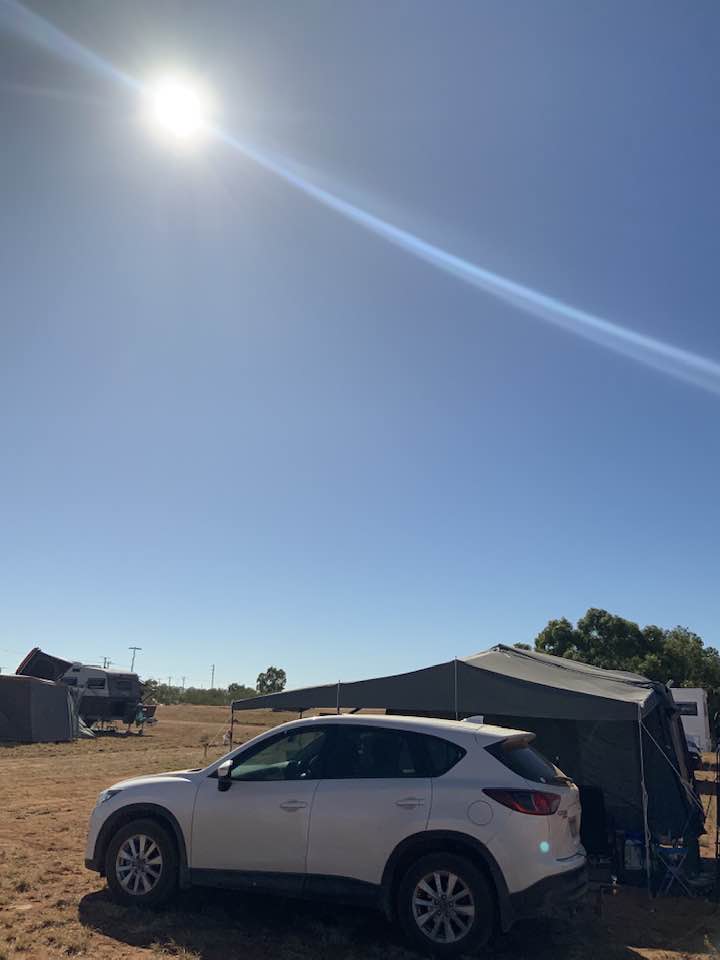
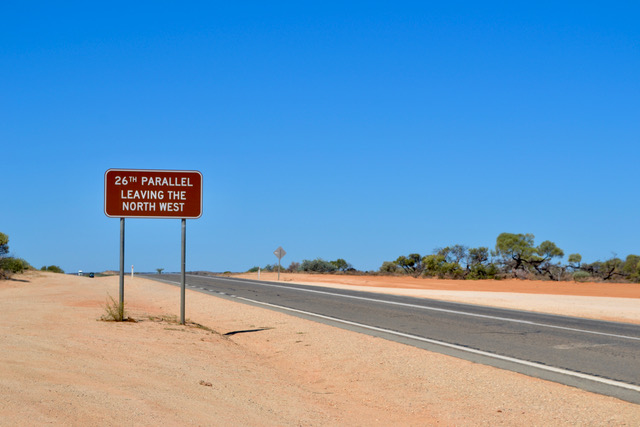
Exmouth WA to Cervantes WA

Our goal after the eclipse was to head to Kalbarri National Park. On the way are a couple of must-do stops to see Coral Bay and Monkey Mia. We had heard from our friends, Leigh and Geoff who were staying at Denman, near Monkey Mia for a few days. We agreed to try to meet up with them. We headed straight to Coral Bay which has one road in and out. It turned out a non-event for us. Basically, it is a beach stay with flash caravan parks/resorts, with what looked like an expensive hotel and coffee shop. You could not move for caravans, on top of each other, with kids, and paddle boards everywhere. We could not even park to see the beach and therefore were unable to tell you if it was of any significance.

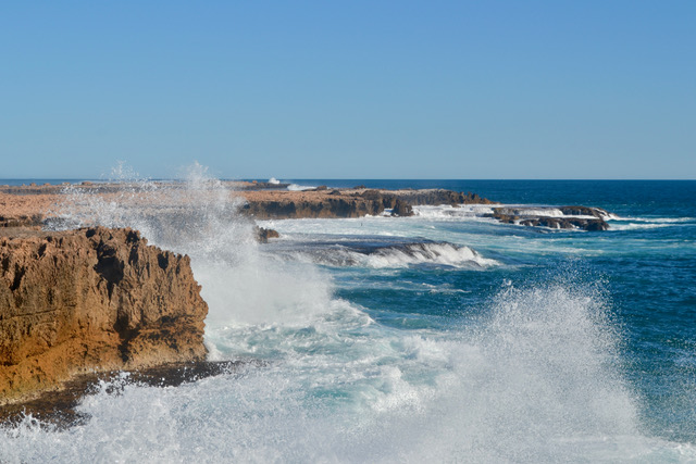
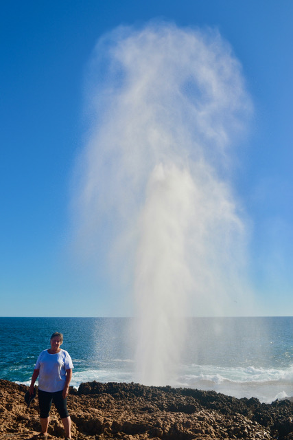
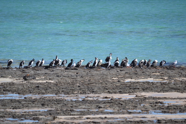
Moving back to the highway we headed down and pulled off before Carnarvon to see the Quobba Blow Hole. We timed it beautifully as the tide was in and the water erupting. This was much more to our liking. It is a natural area, with no lookout, fencing or commercialism and only a few humans around. You can walk across the rocks close to the water’s edge. It was not dangerous although some caution was needed due to it being wet and slippery.  The water was fiercely blowing up through the hole when we arrived. We were able to get quite close to the opening for some great photos. Getting wet was fun and a bonus as the day had been very hot and dry. We went for a walk up the beach to a small lookout to view another cove with yet another inviting family-style beach. We noticed a large flock of sea birds sitting on a rocky outcrop nearby. The afternoon was quickly fading and so we moved on.

We decided to take our time and stay at Carnarvon once again to wash our clothes, and to enjoy some hot showers. For a few days now I have not been feeling well, hacking cough etc. Checked for covid but all clear, just a good old cold, just enough to upset our plans a little. My walking skills were a bit subdued, and my planning ability was out the window.

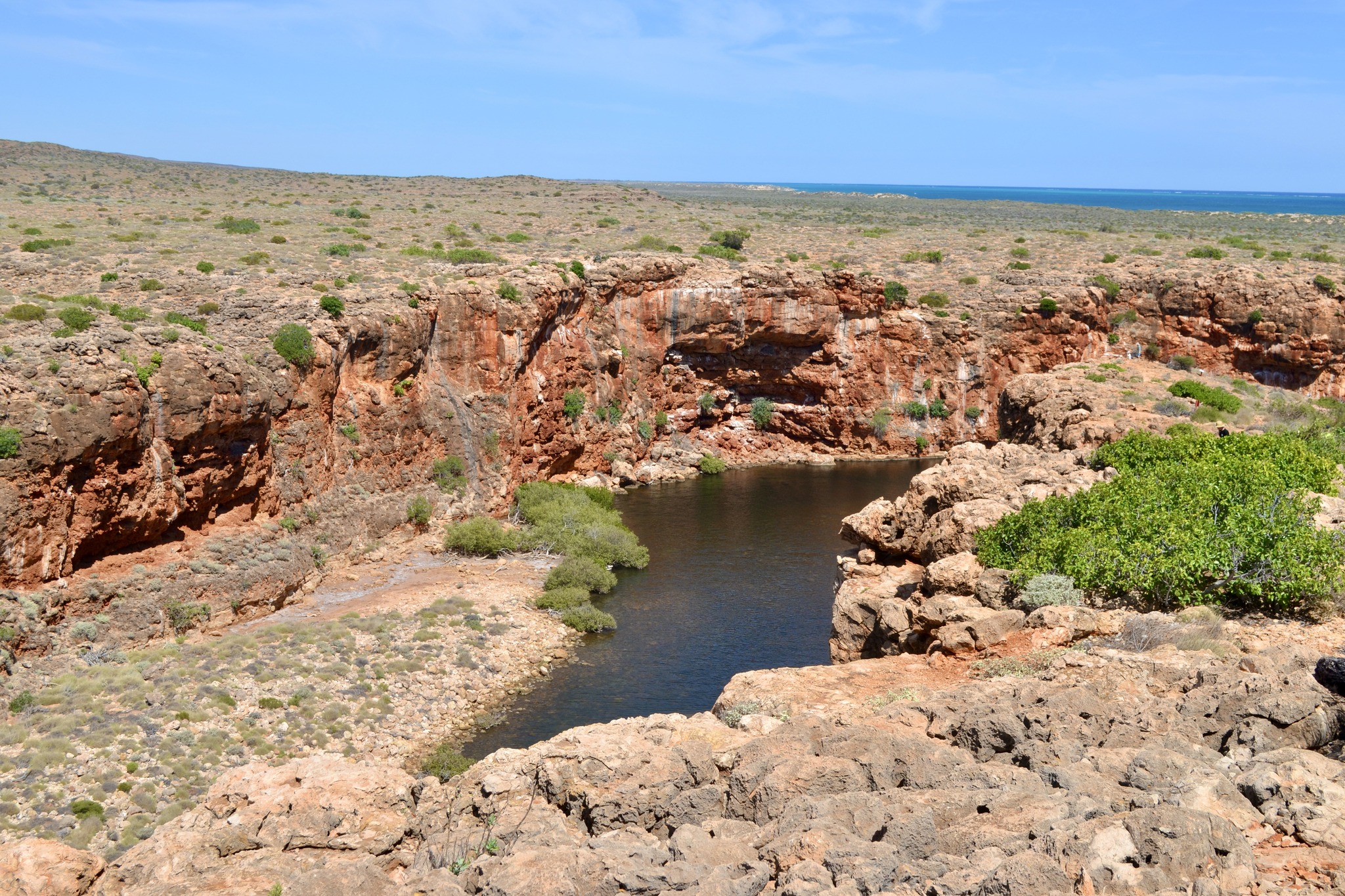
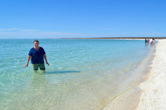
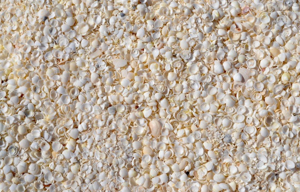
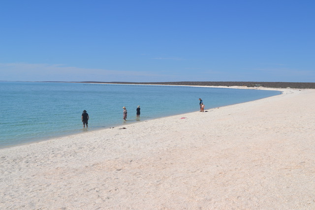
The next morning, we packed up early and we were looking forward to seeing our friends at Denham. Of course, our car does tend to veer off the road at every camera or tourist sign.  Hamelin Pool to see the Stromatolites was our first detour. We see the stalagmites, and the stalactites many times but this was new to me, at least. It was a short hot walk to the beach from the car park and unfortunately, the jetty had been damaged in recent storms and the access to these living fossils was not great. There are information boards but a large wire fence between you and the fossils. Hopefully, they will get the jetty fixed so others can enjoy them. The next pull-off was Shell Beach, Shark Bay, which was fascinating. Millions of tiny shells covering a 60km stretch to a depth of 7-10 metres. It is a pure white beach with shallow warm water to paddle in. A little hard on bare feet though. Our water shoes would have been a good idea, had we thought of it.  Nonetheless it was quite pretty, and the water was beautiful.

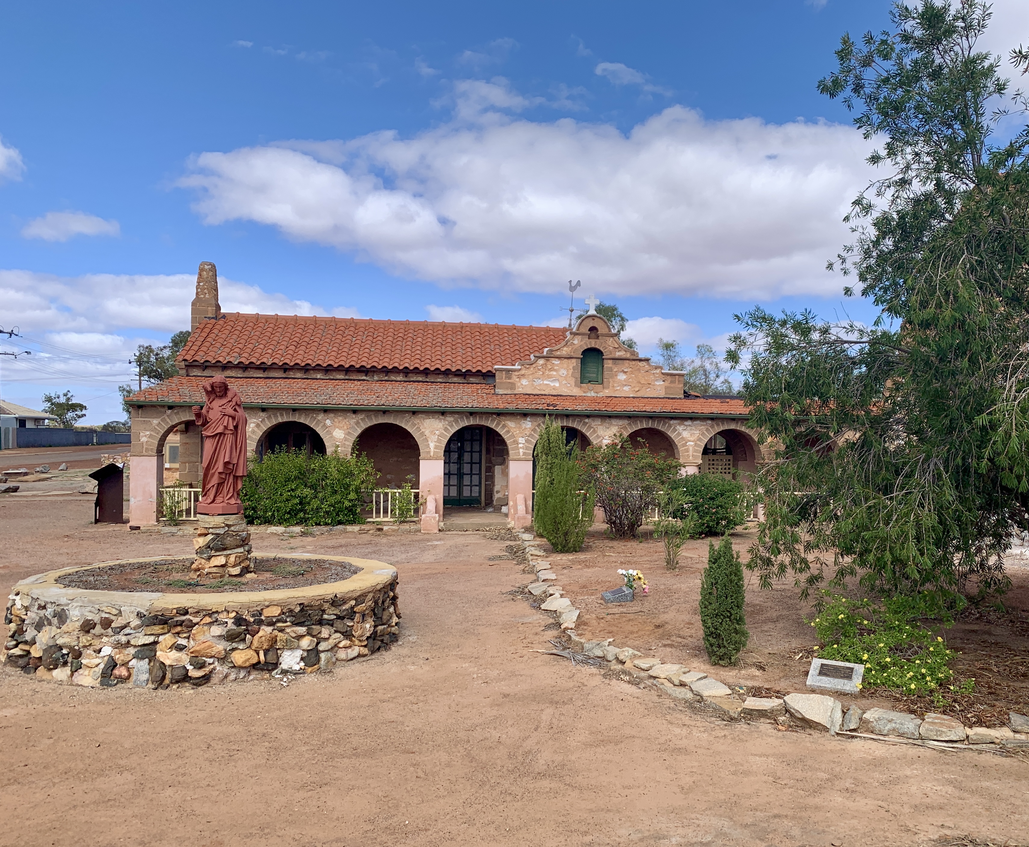
After the beach a pull-off to an historic telegraph office and beach. Not worth a mention as it was not an inviting-looking area. A little rundown and neglected, I do feel it needs some work to appeal more to the public.

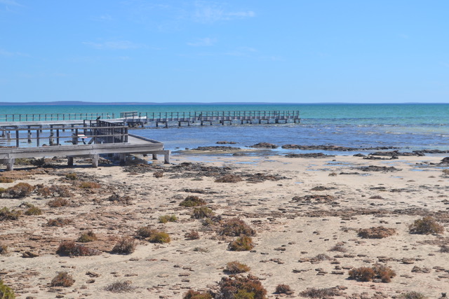
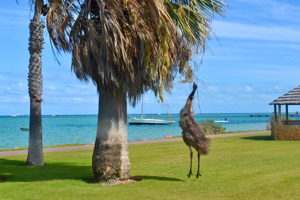
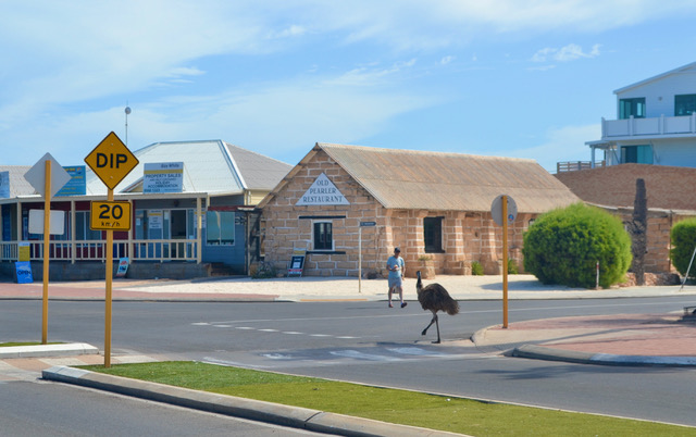
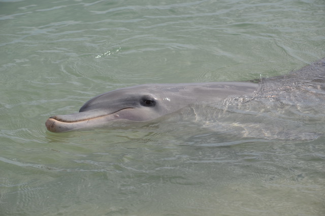
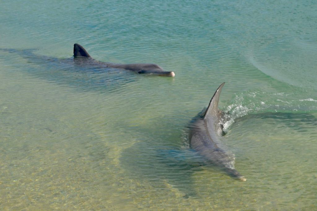
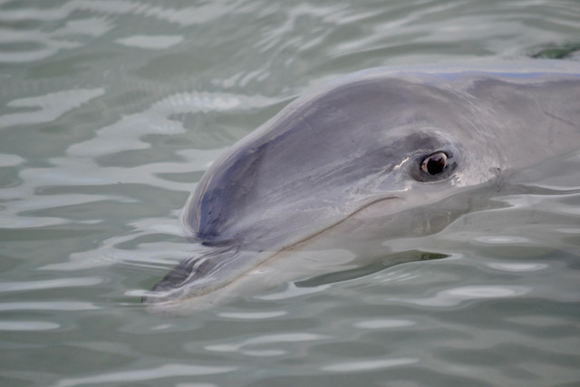
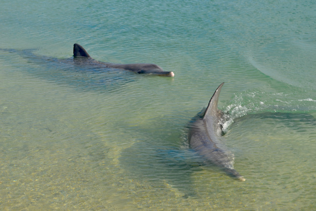
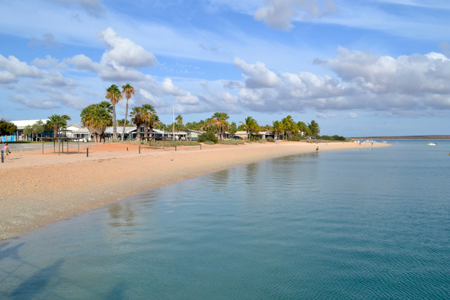
We moved on quickly to Denham. This is a quaint town with a manicured esplanade running along the beachfront. It is a popular town for boating and fishing and the gateway to the Shark Bay World Heritage Area The caravan parks looked full, and we suspect a lot of holiday rentals were at capacity. We were lucky, as Leigh and Geoff had an Airbnb which had an extra room and bathroom facilities downstairs. For the first time in many weeks, we were able to have a normal bed and a normal bathroom. This was just as exciting as seeing our friends. After a cold cider and some catch-up conversation, it was decided a swim was in order. We headed off for a lake nearby. It was a short drive and within a dozen steps of the car, the water was shallow and warm. We lazed in the water and chatted some more until the late afternoon air chilled our bodies. Back to our accommodation for shower and clean clothes for a night out at the local. We headed down to the most western hotel in Australia for a great meal, some wine and more talking. As we woke from a sound sleep, we looked forward to our trip to Monkey Mia. We had heard lots of good things about this place, and I was thrilled at the prospect of seeing dolphins up close and personal. Driving another 20 km from Denham we arrived at what appeared to be a holiday resort. There was a large information and gift shop and a walkway to the jetty where the dolphins were expected to visit. The area is very resort-style, with large parkland for children, a large restaurant and easy beach access. The dolphins are expected two to three times each morning. You wait near the jetty and once the dolphins are seen in the distance, two guides join you with stories of their families and their behaviours. They do come into the water’s edge and the handlers feed them fish. They allow you to stand at the edge of the water, however, you are restricted in how close you can get to them. It is a lovely experience as they are majestic and playful creatures. The whole experience lasts for half an hour at which time we wandered up for lunch as there was little else to do. There are emu wandering around the play area and around the restaurant which are cute to watch. We returned to the Airbnb, happy at what we had seen but underwhelmed by the whole experience. I expect if we were the type that loved sunbaking on a pristine beach then we would have appreciated the effort more.

I spent the afternoon working and Ken caught up on some photo editing. Geoff decided to cook us a gourmet seafood dinner that night. He is a pretty good chef as we have experienced his excellent culinary ability previously. After a couple of glasses of wine, a walk along the waterfront, holiday tiredness crept in. As our friends were leaving earlier than us the next morning, we said our goodbyes that evening and let sleep take over once more. 

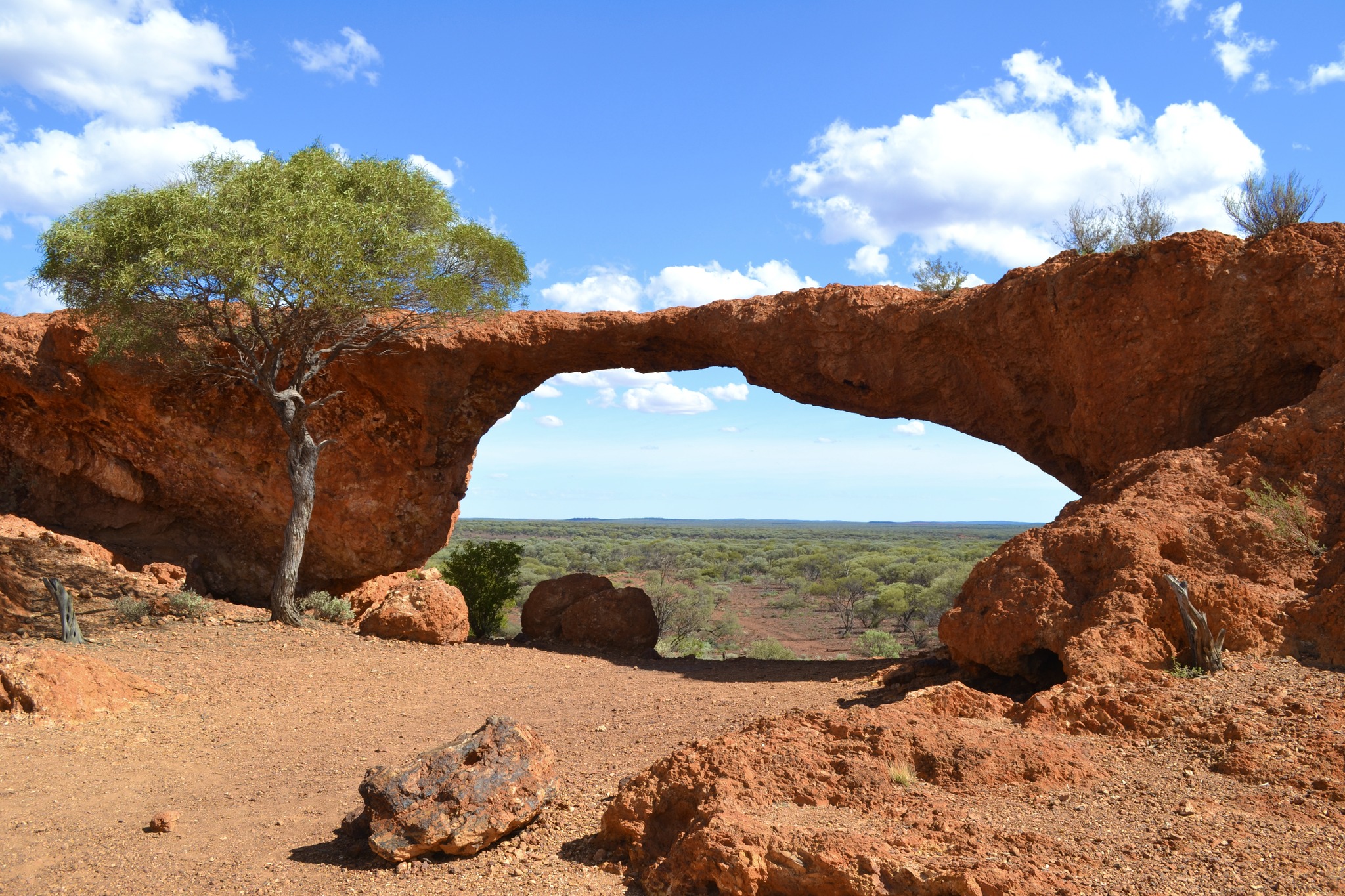
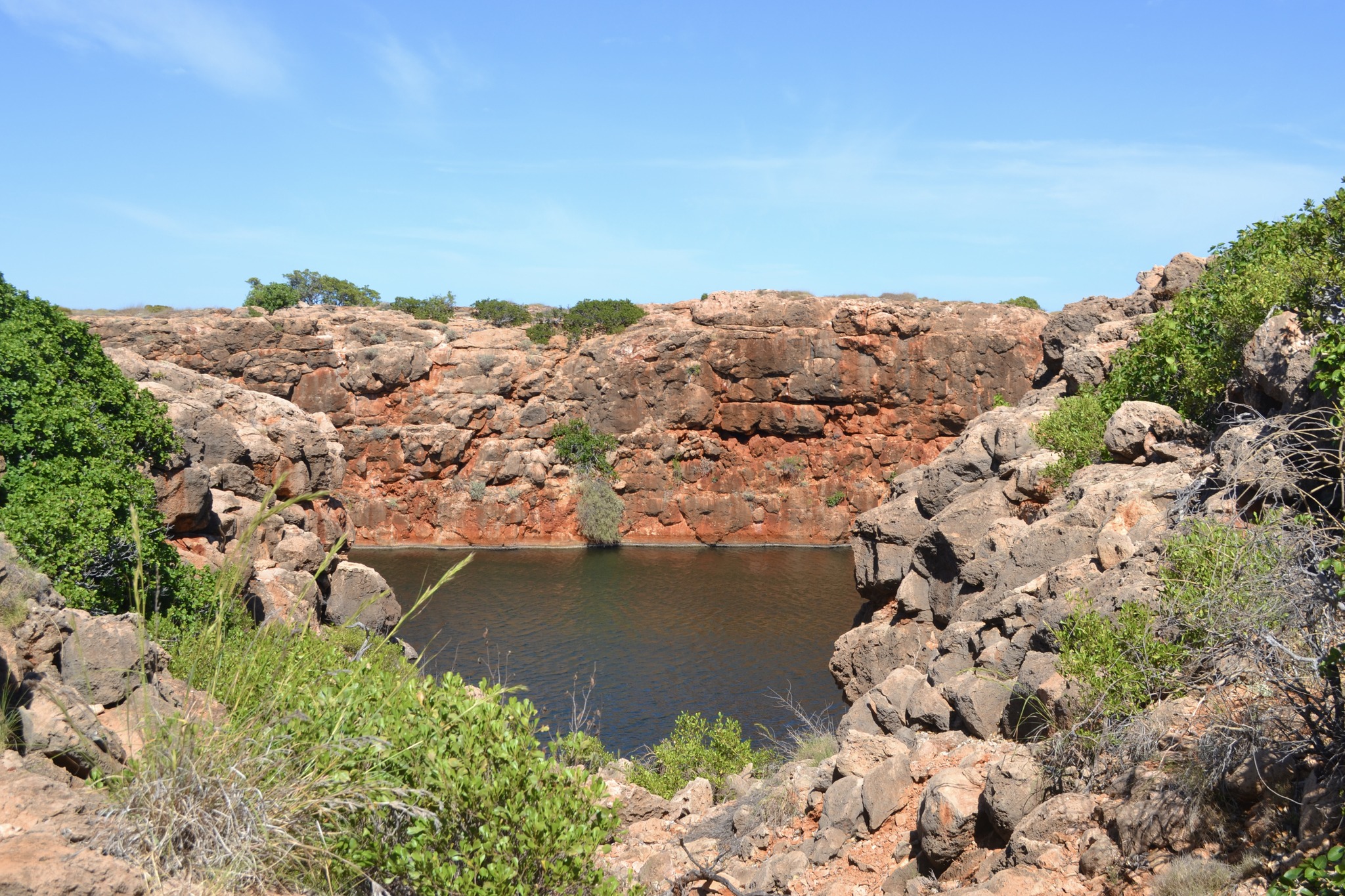
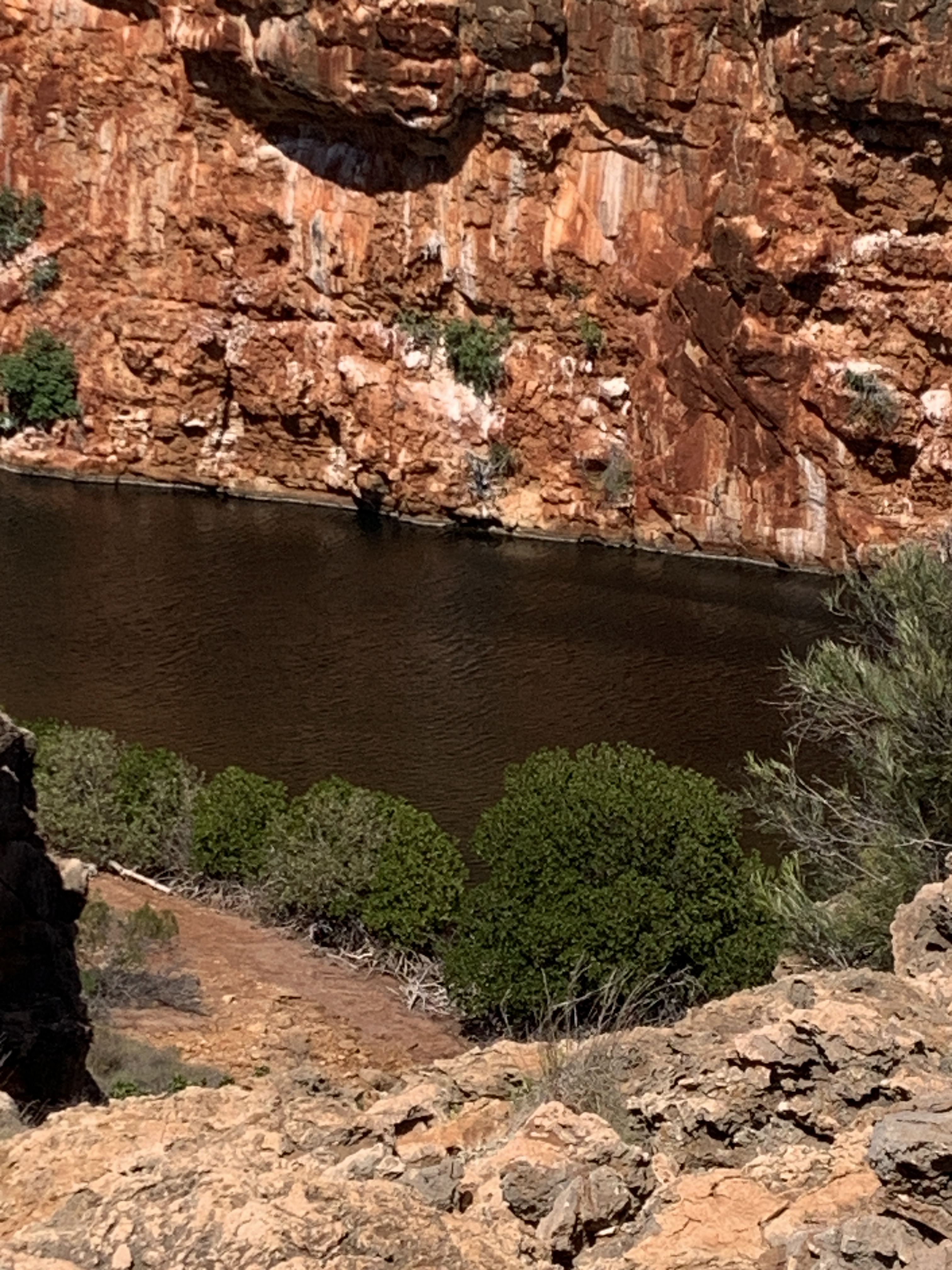
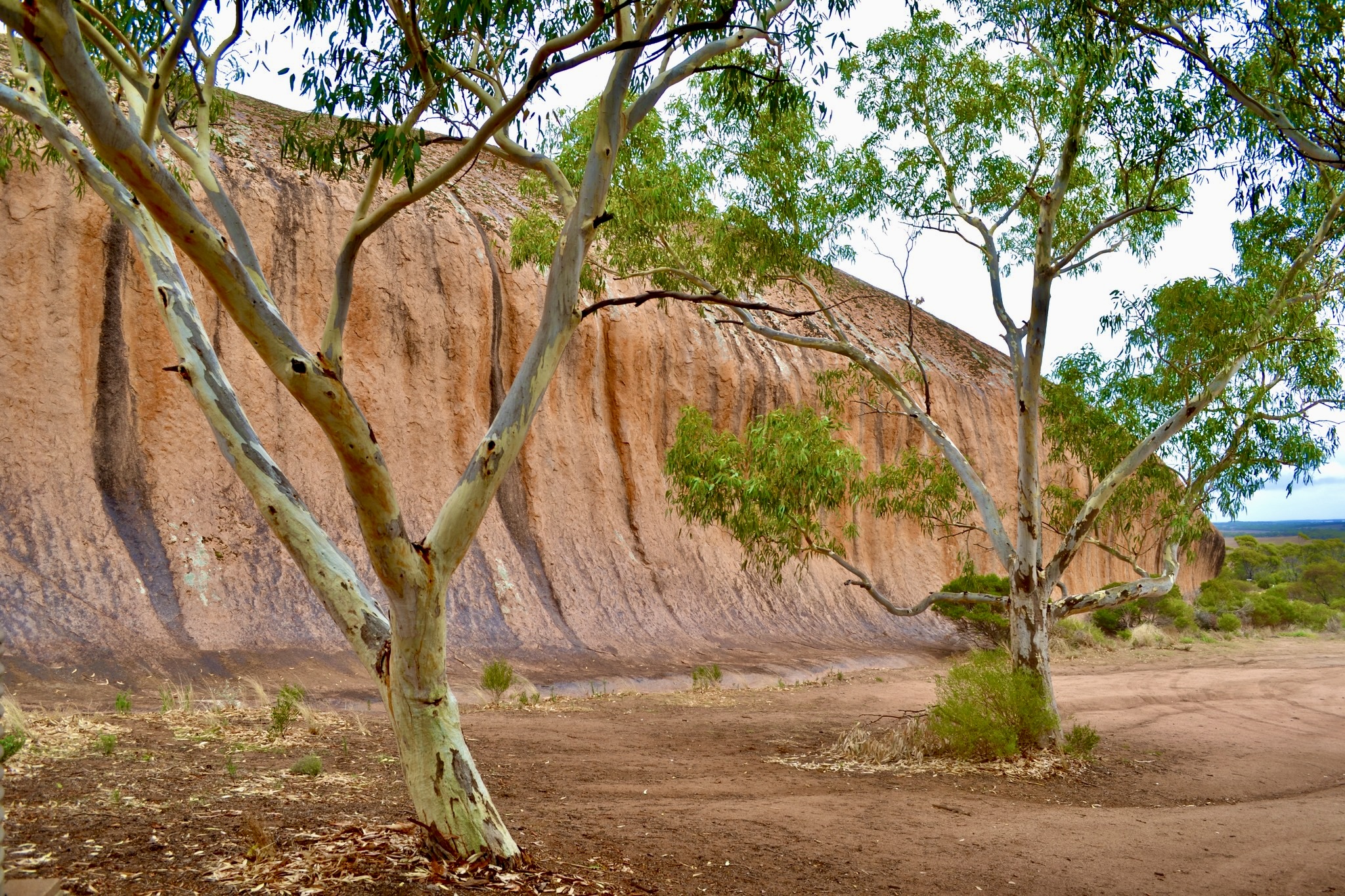
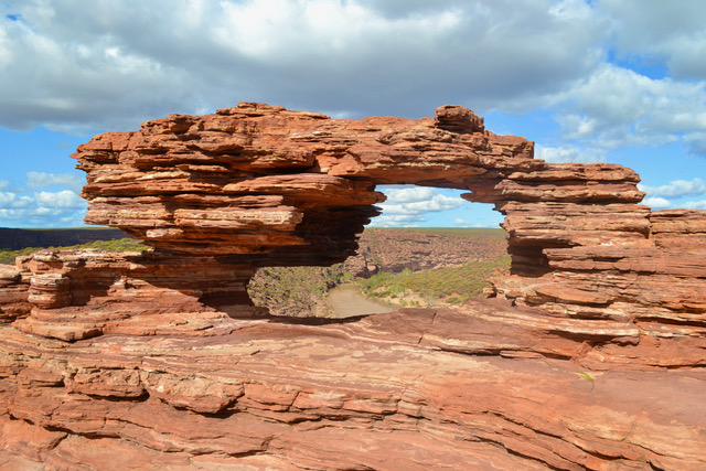
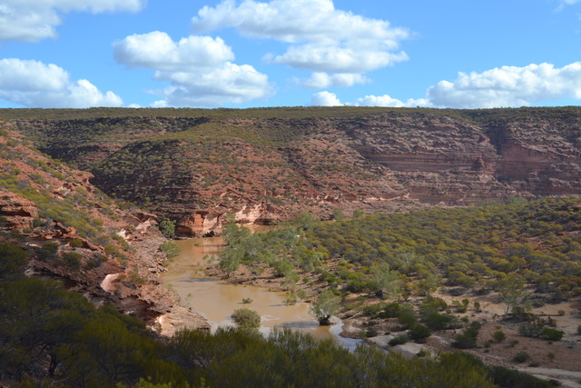
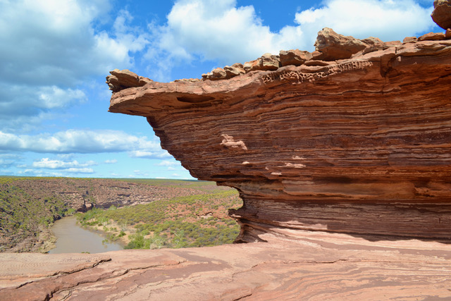
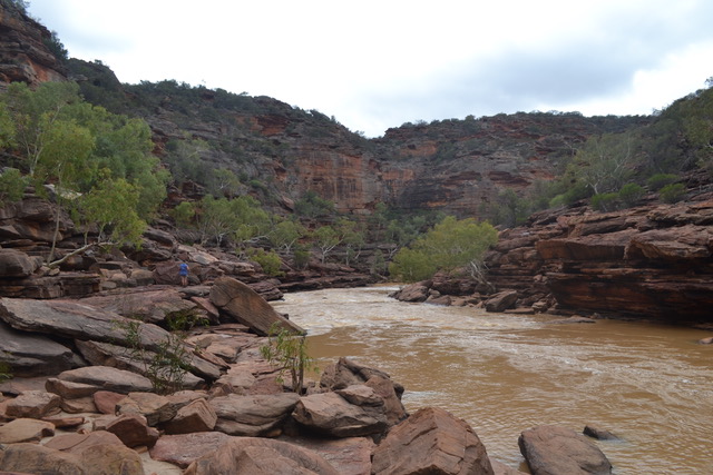
Another 350 km down the highway brings us to Kalbarri National Park. The road off the highway is pretty much all national park. The first walk we encountered was Nature’s Window. It was about a 1.5 km walk on a boardwalk with a little bit of rock navigating at the end. The large rock window allows one to look through into the Murchison River and its surrounds. The scene is perfect and beckons for a photo. The national park spans 186,000 hectares so looking out from the rocky outcrop was stunning. My cold was still persistent and so I found the walk back up was draining.

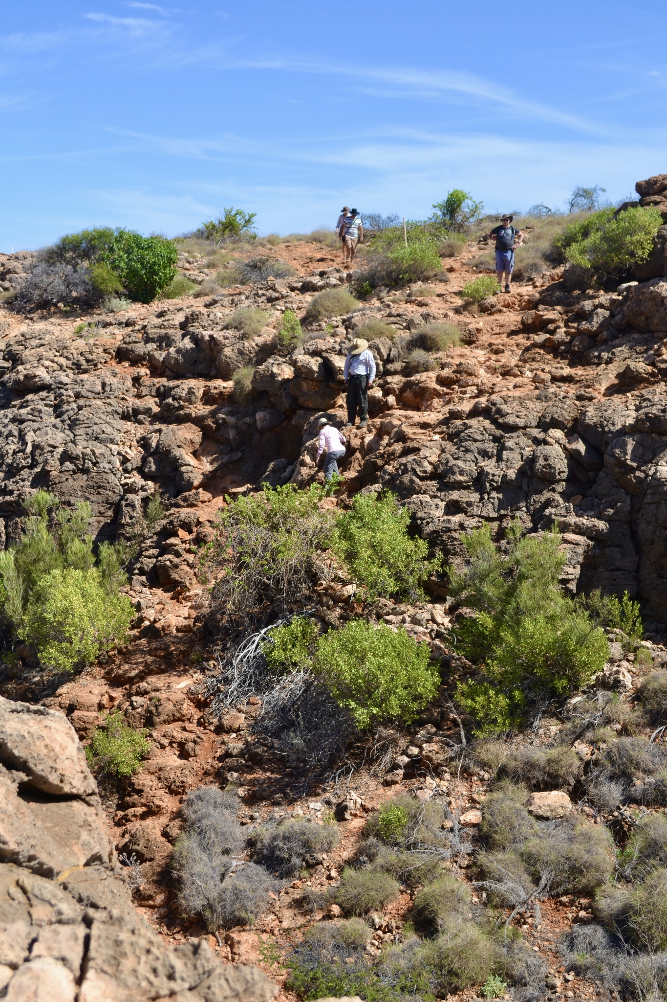
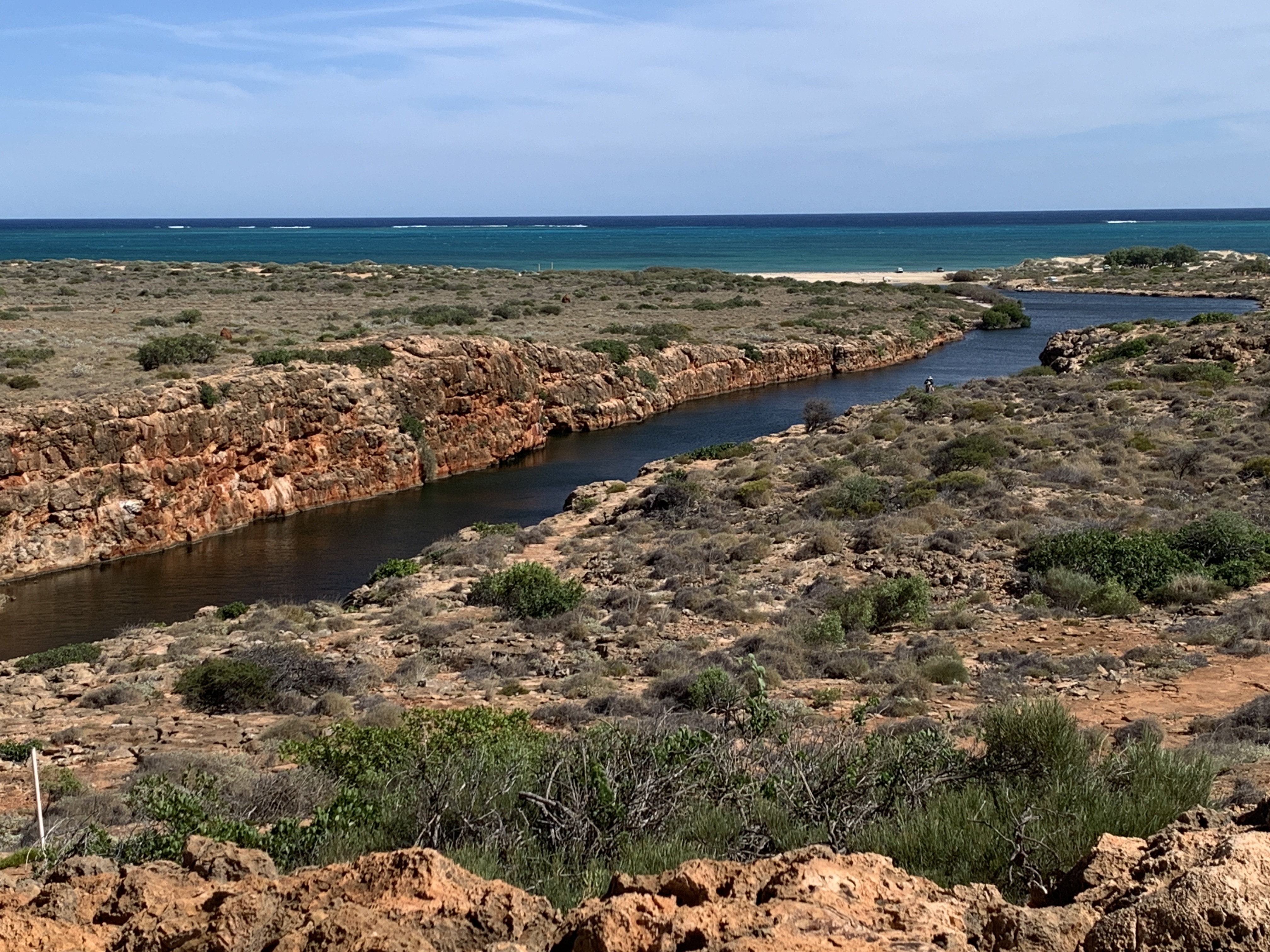
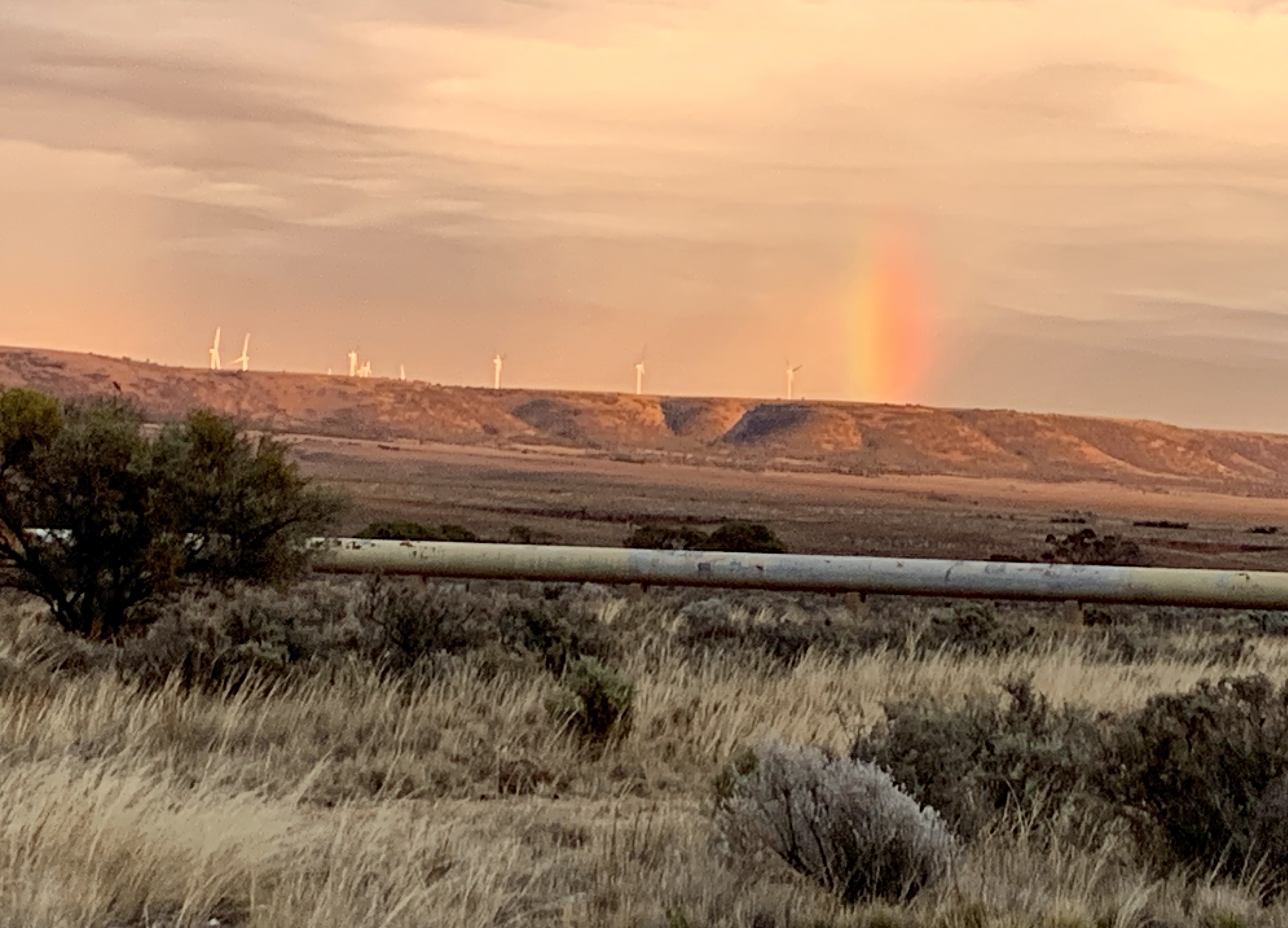
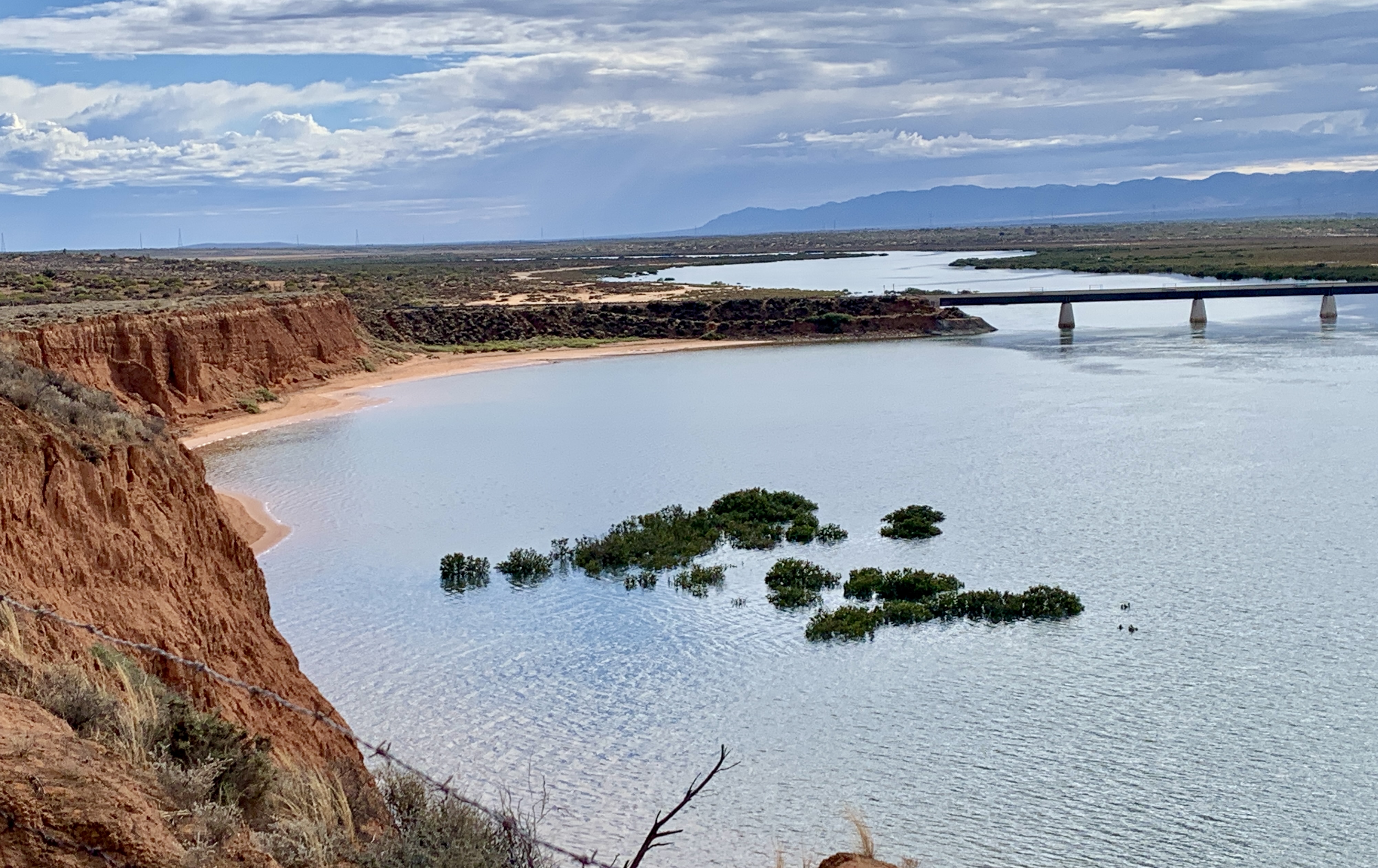
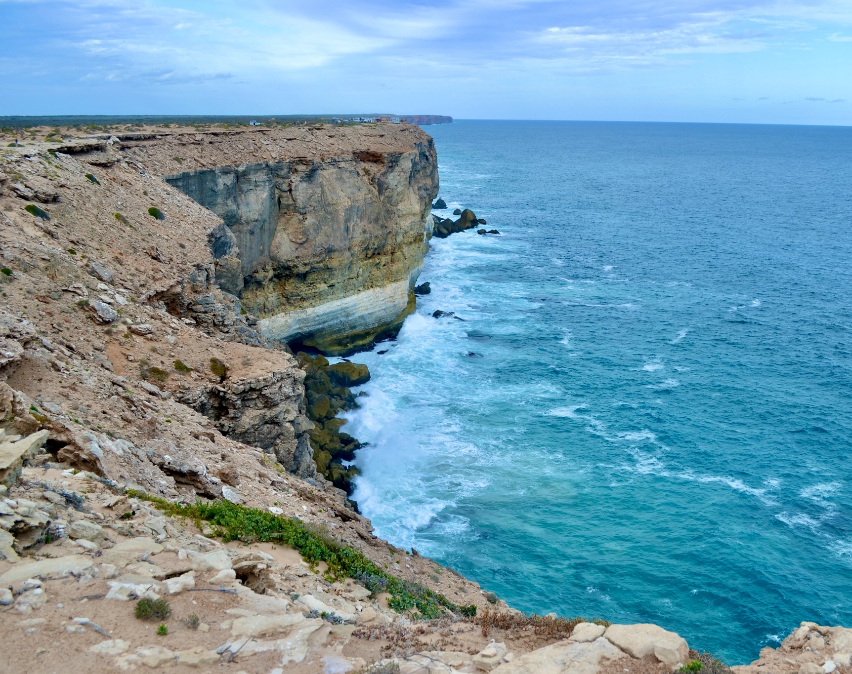
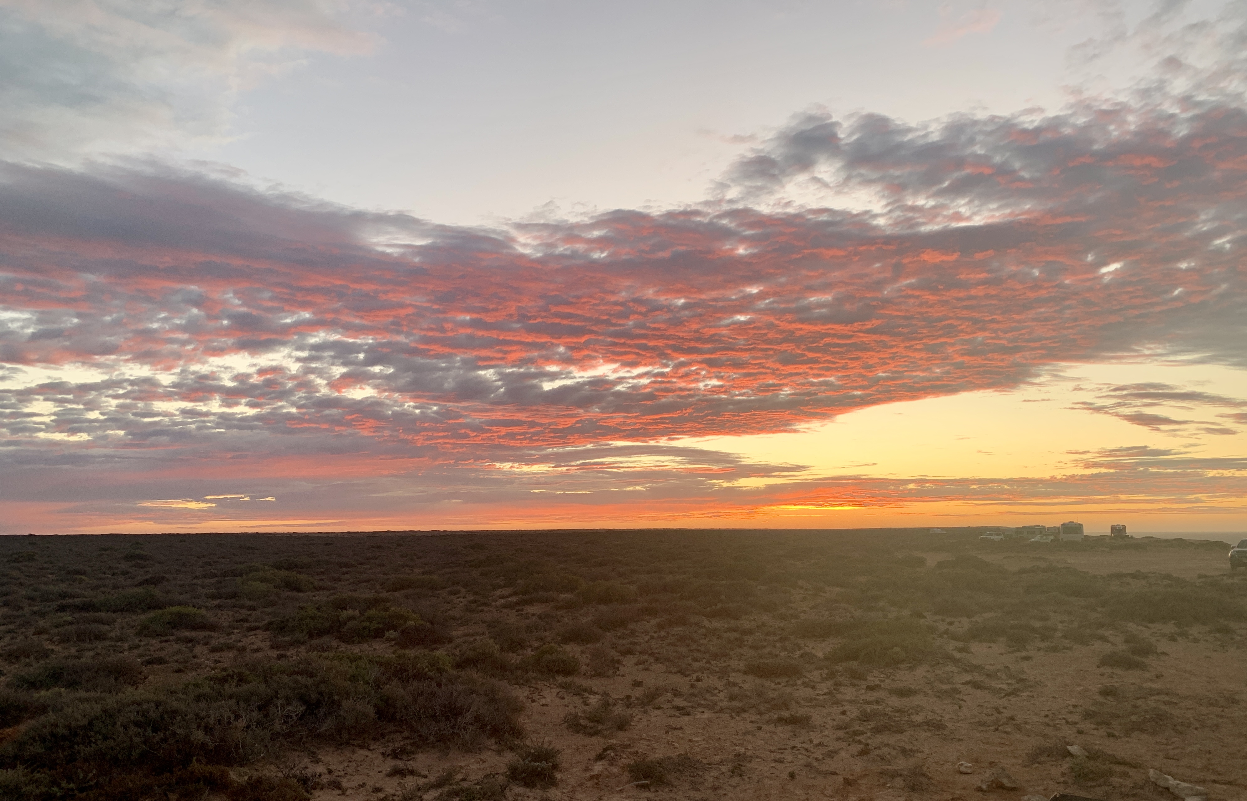
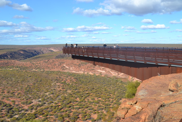
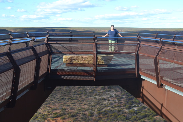
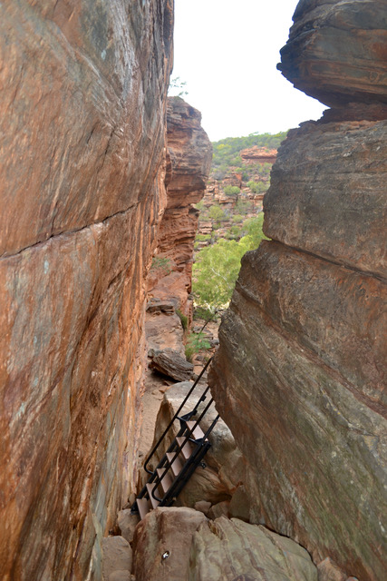
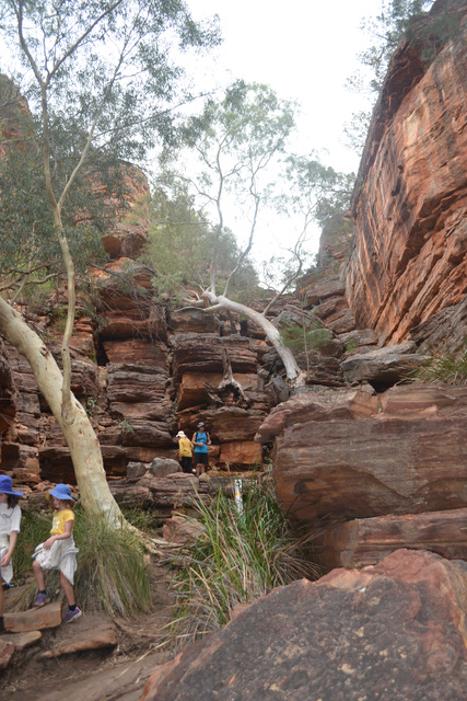
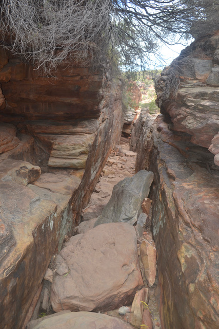
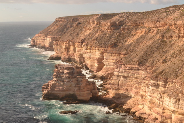
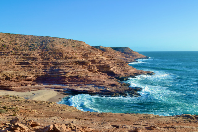
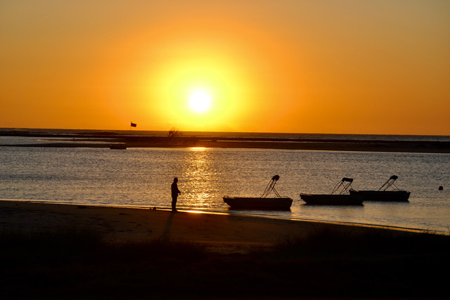
A short drive further on and you come to the Kalbarri Skywalk. This lookout allows you to walk out onto two manmade structures with see-through flooring extending over the valley. It is very pretty and easily accessible but personally standing on an undeveloped piece of land high on a cliff top is more exhilarating. Having said that the lookout and the sealed walking paths do allow a lot more people to access the beauty of this country. Once again there is a lot of information displayed and a tiny café available for resting. Overall, it is a very picturesque place to visit. There were several more drives and walks available but as it was getting late, we headed into town to secure our accommodation. Free camping was not as forthcoming along the coast, so we headed to a caravan park on the main road opposite the foreshore. That night, hoping for a nice sunset we wandered over to the park on the beach and were rewarded with a very beautiful peaceful crimson sky.  The next day the intensity of my cold meant I did not want to do any further walks. Ken of course took off to investigate some more of the National Park while I rested.  To his discomfort, he encountered another rock scrambling climb down to the bottom of a gorge. He was, however, rewarded with a glorious photographic scene. After another couple of walks he returned a very happy man. We then took a drive through the town and investigated the many ocean lookouts along the way. They all have easy pathways and the views varied at each stop. A little cold and windy but a sunny sky made it a very pleasant afternoon. Another nice sunset over the water saw an end to the day. It is a very pretty town, with lovely scenery, beaches, and some spectacular lookouts. This may have been my favourite place as far as being comfortable and relaxed.

Leaving Kalbarri, we headed down the coast toward Cervantes. As I said we had taken a drive the previous afternoon to check out these turnoffs. We could not help but look again. The morning sun gave us a slightly different view.  We were now ready to move on and hungry to see more of what WA had to offer.

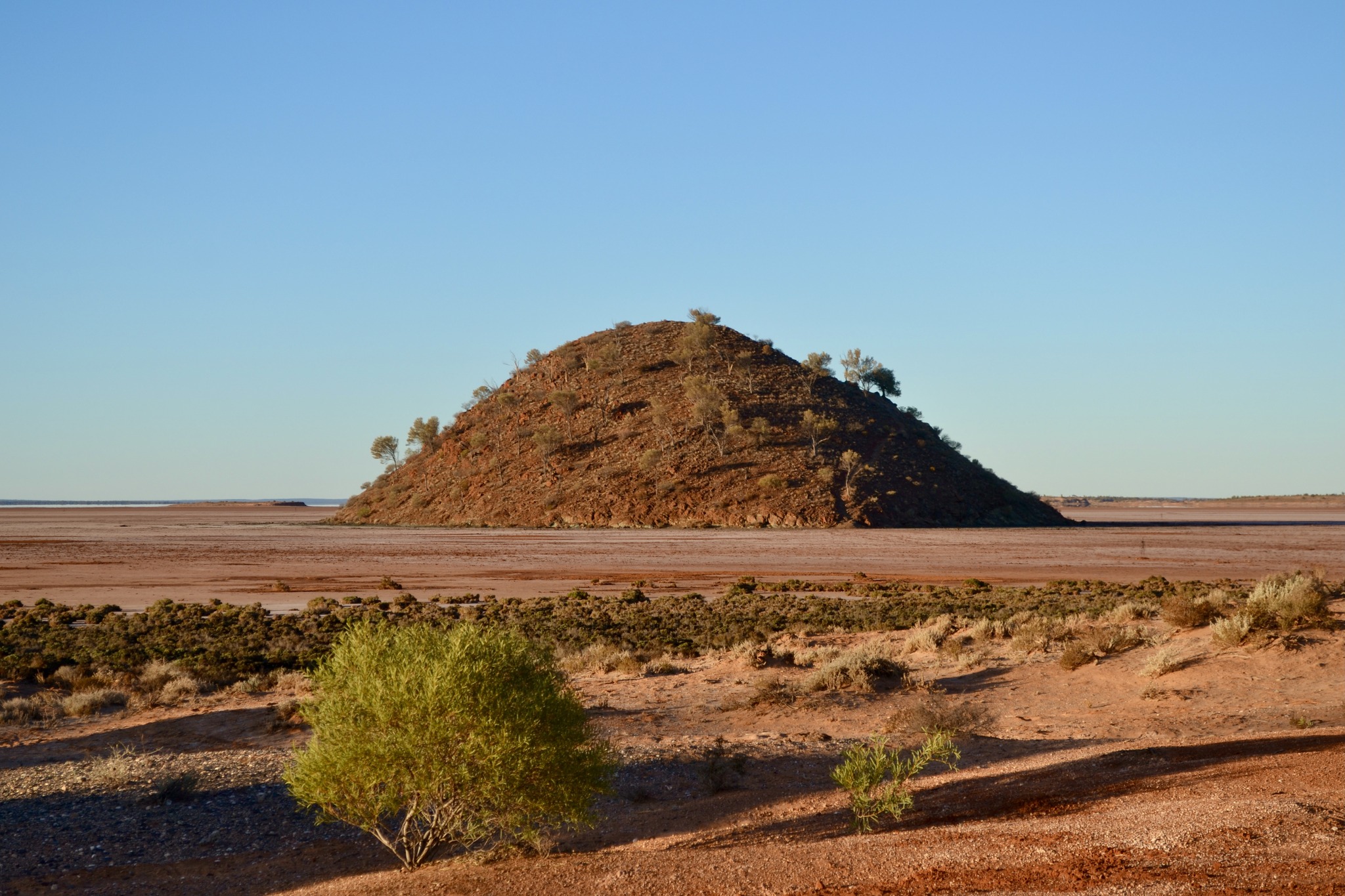
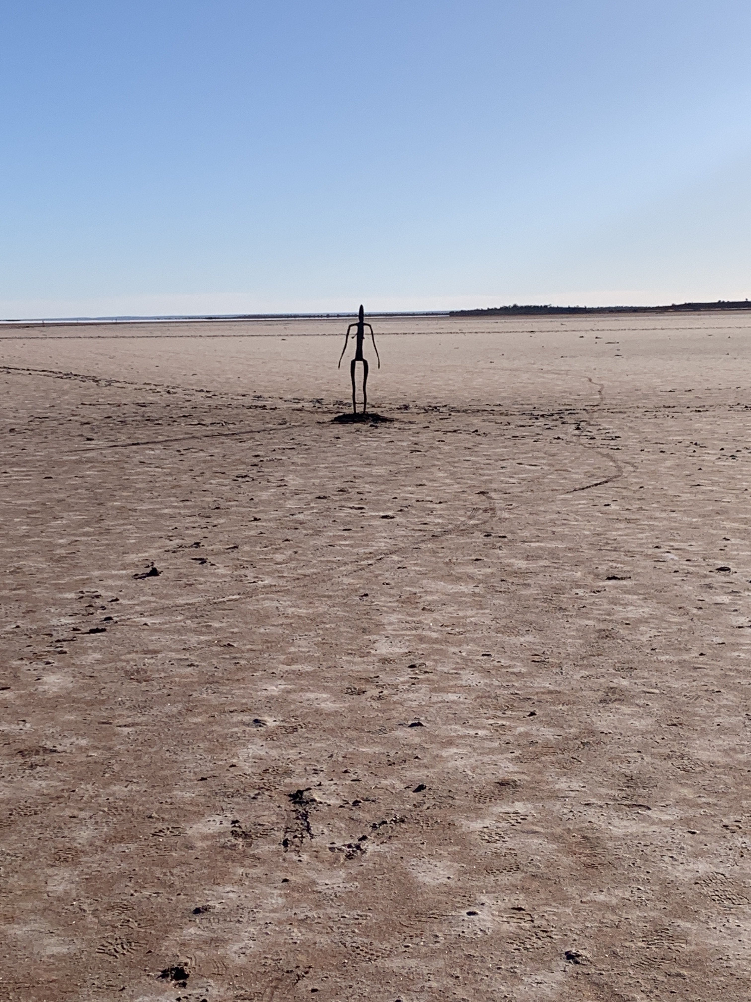
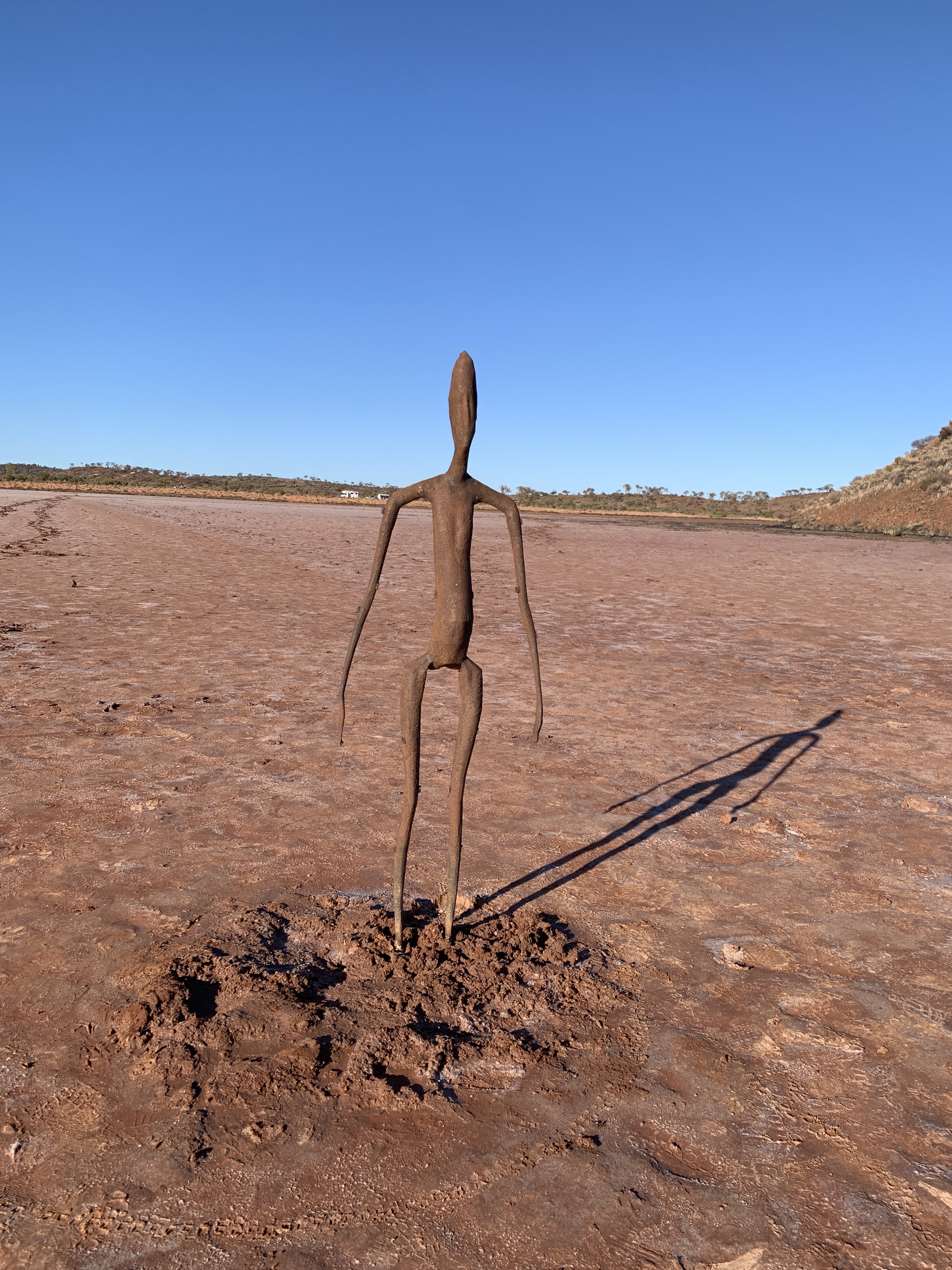
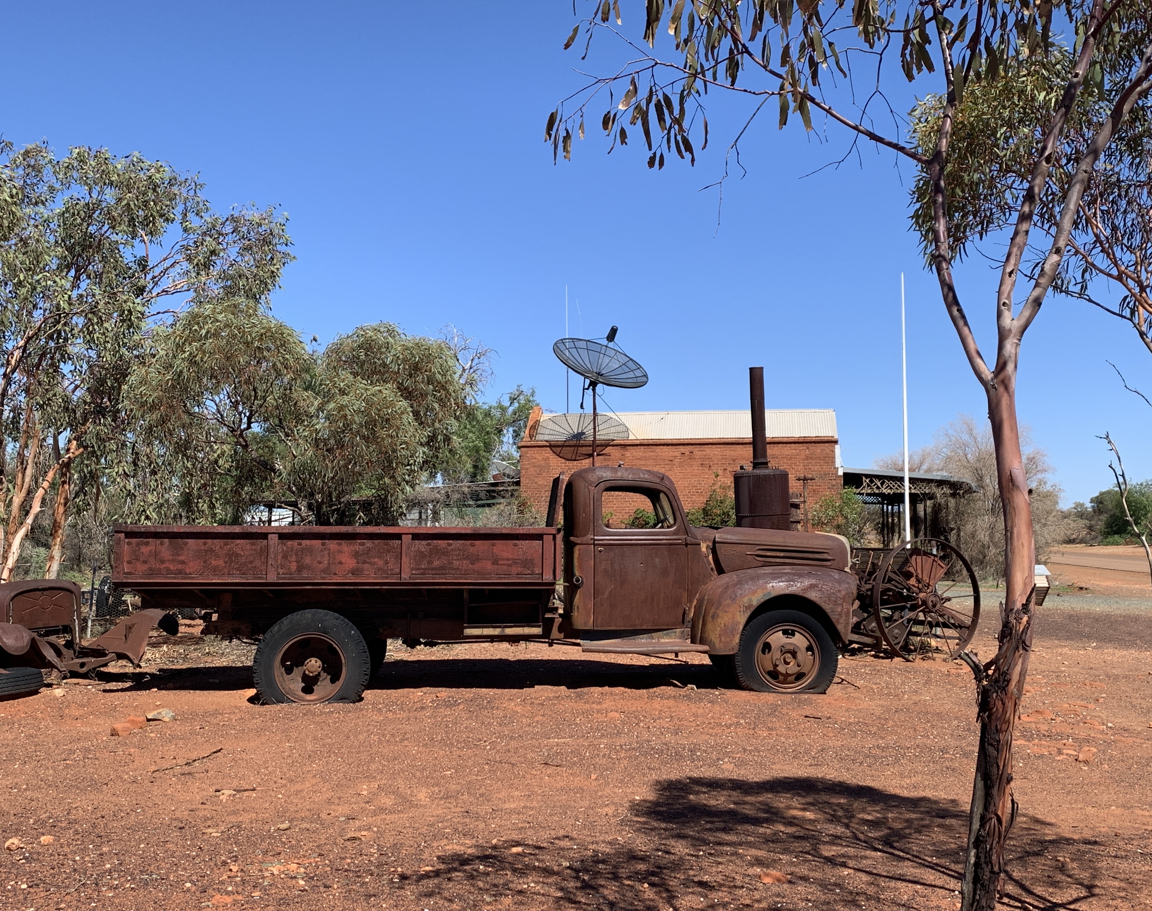
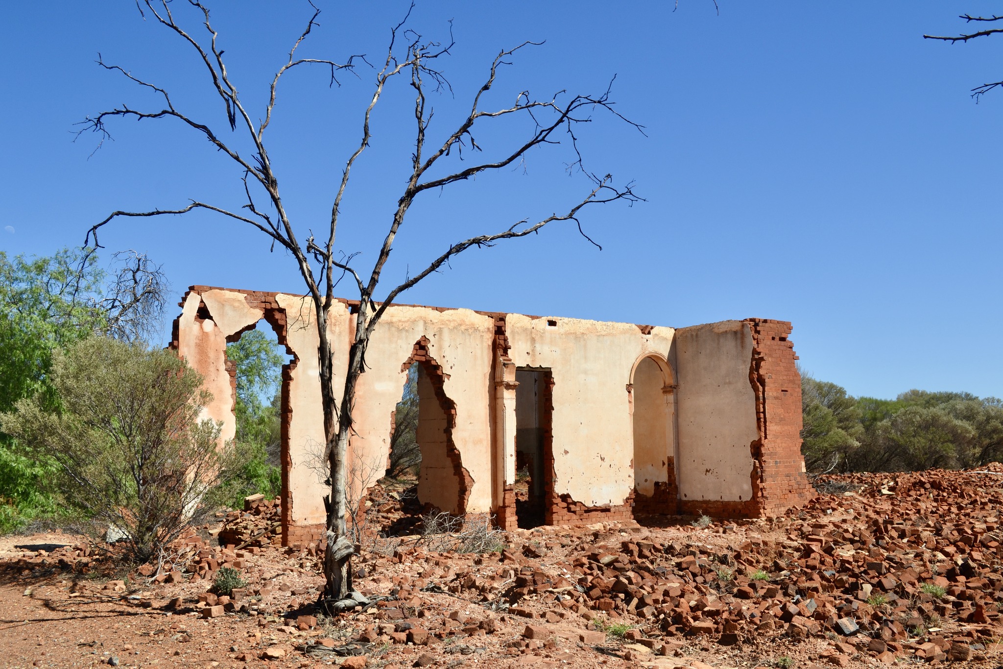
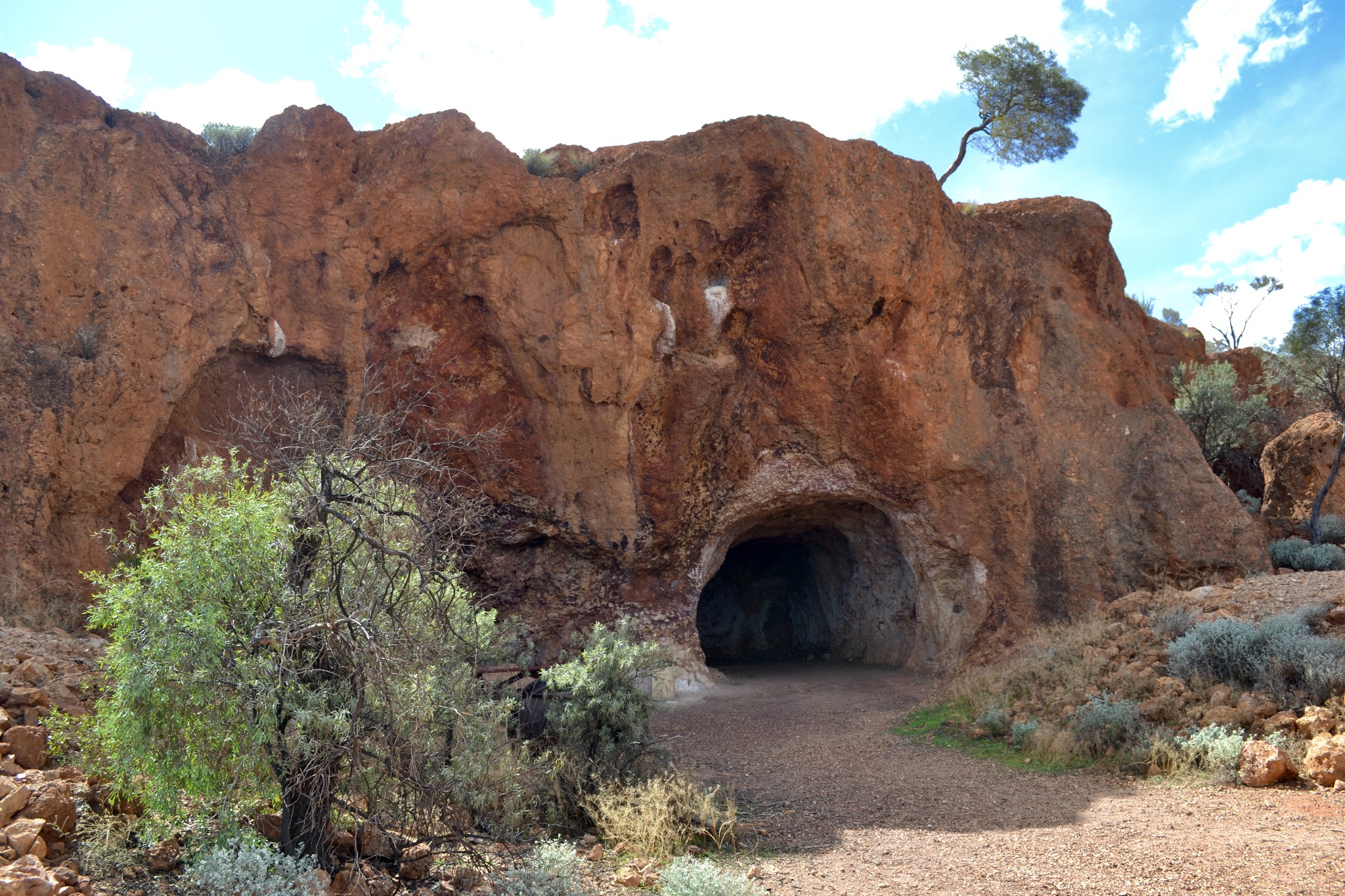
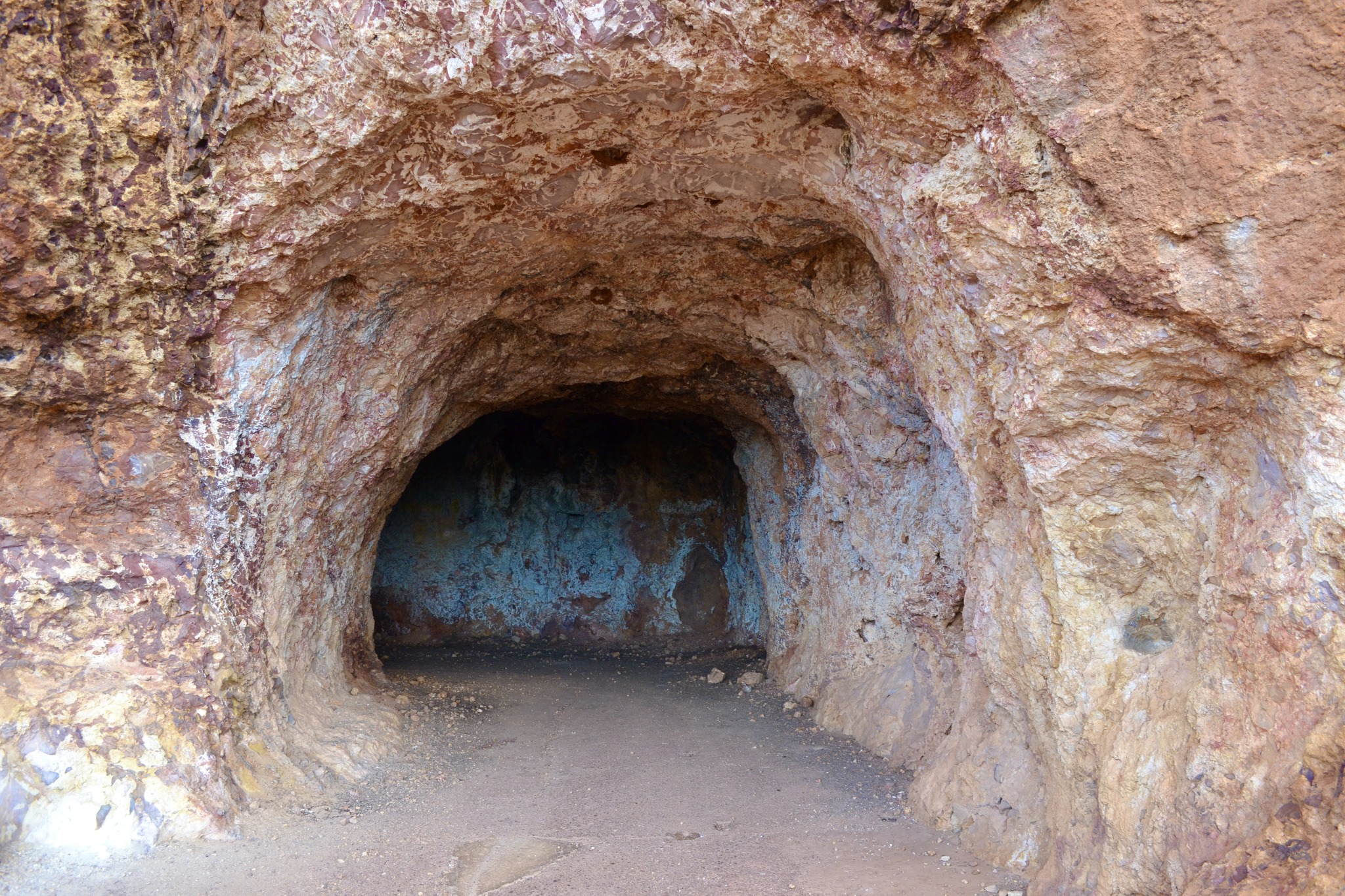
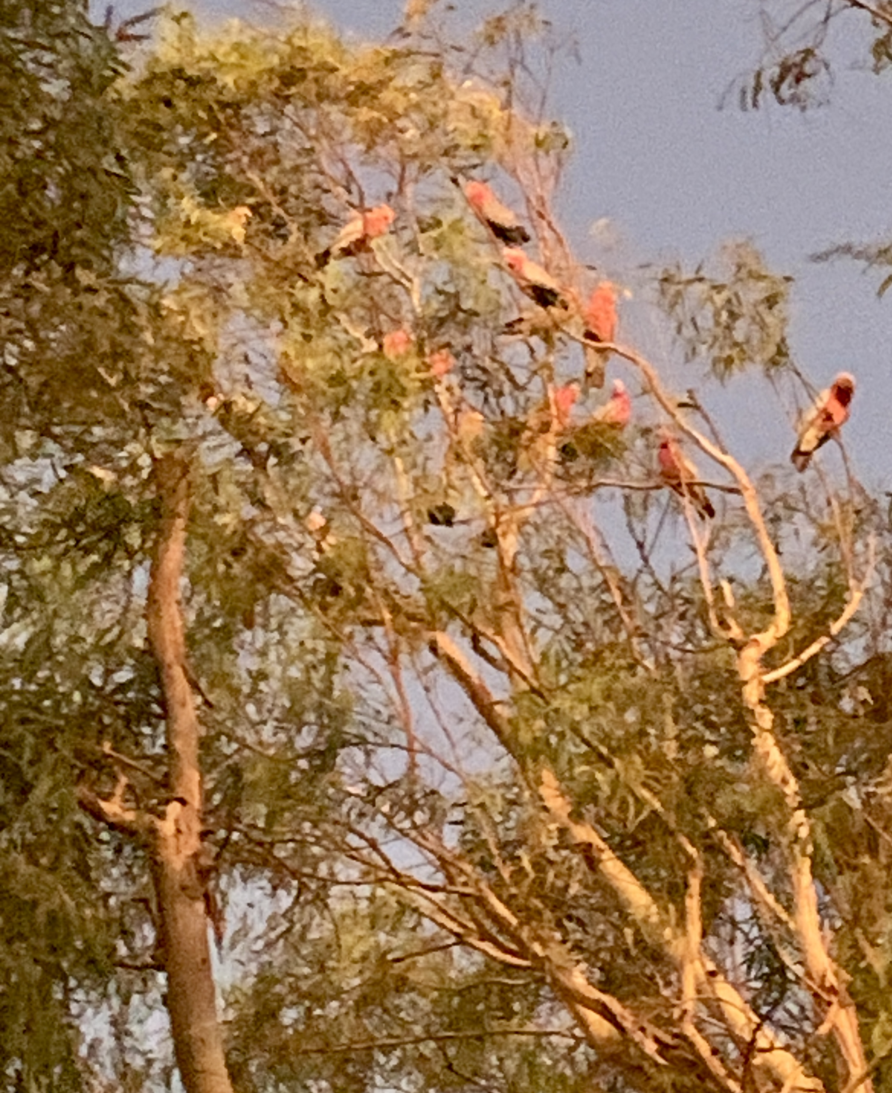
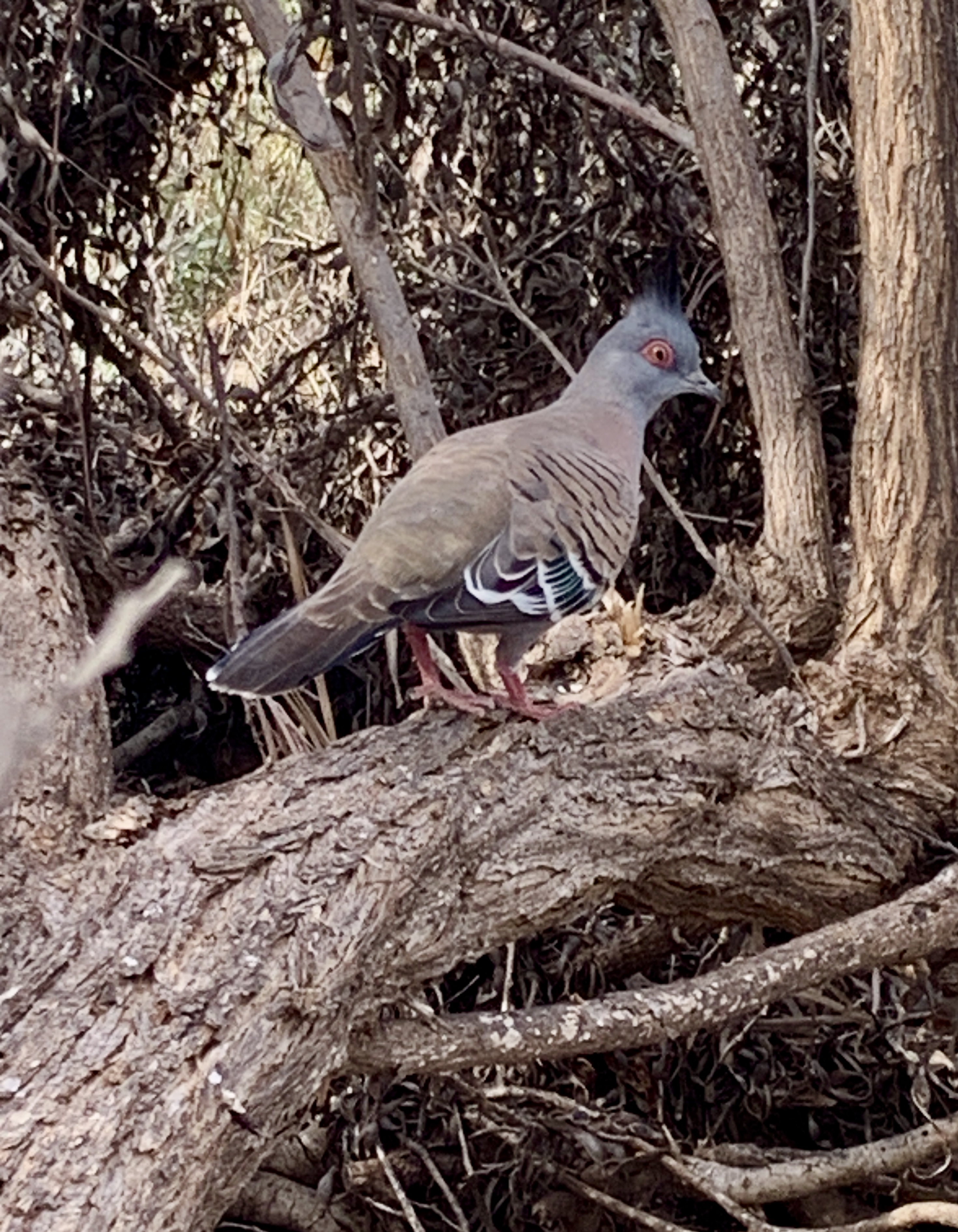
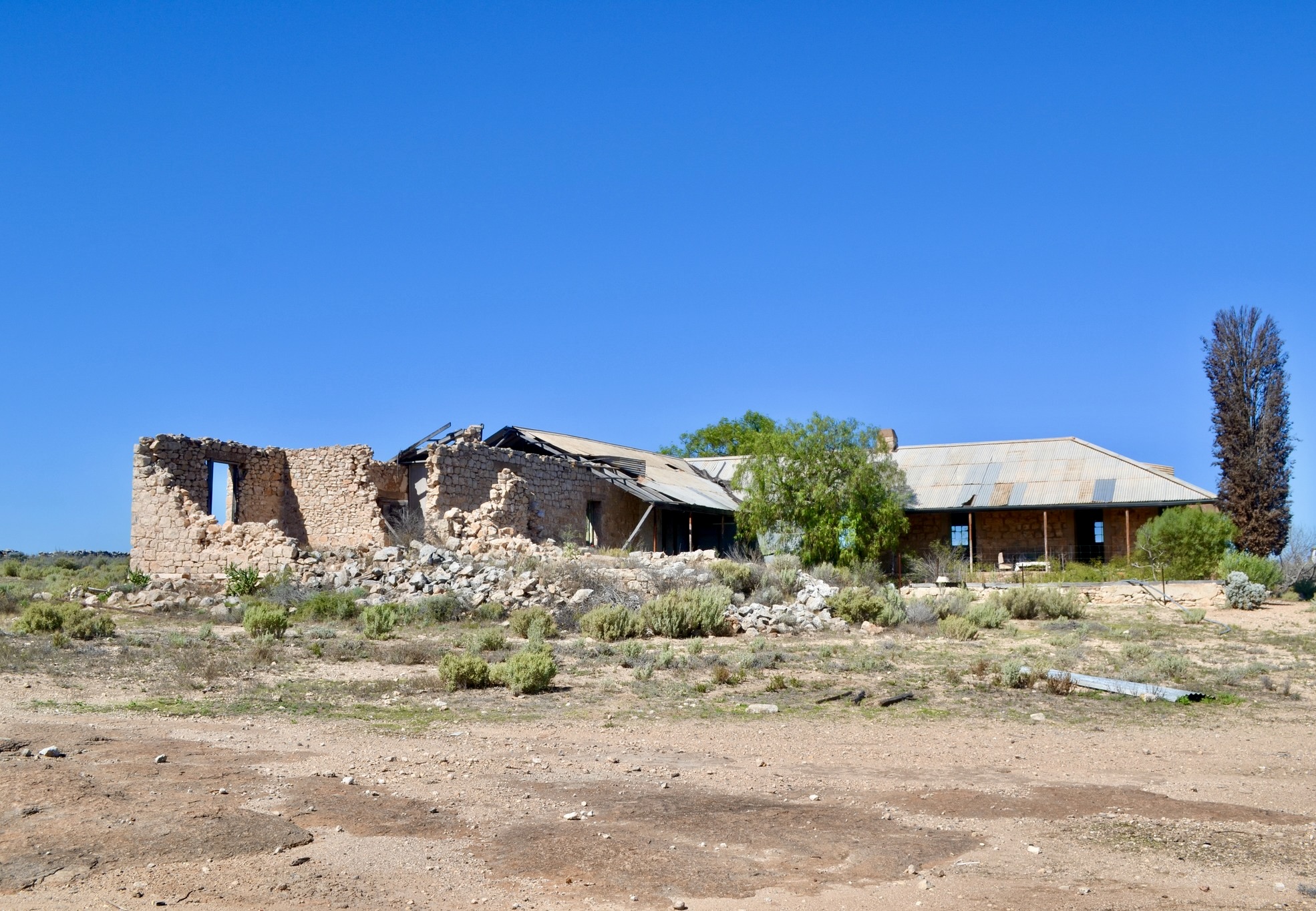
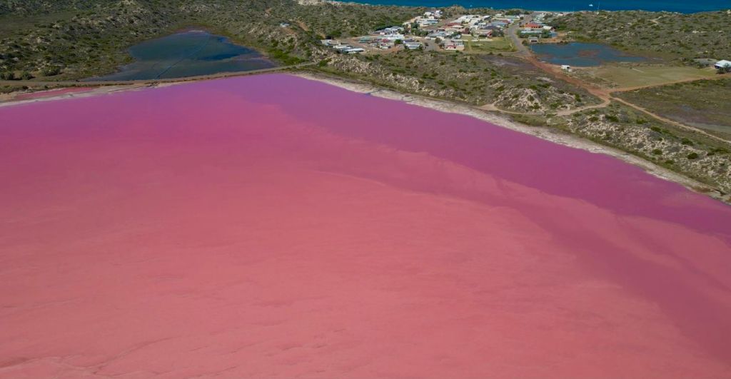
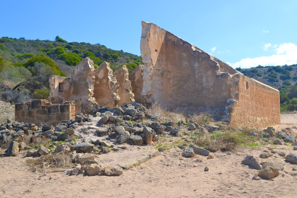
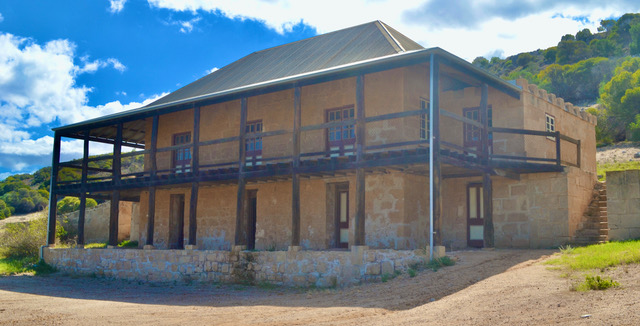
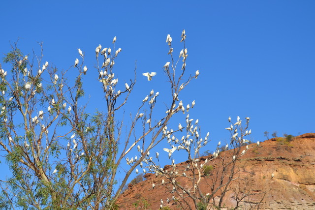
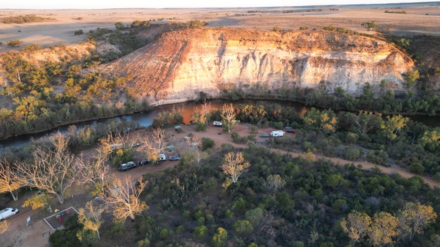
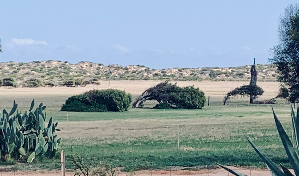
Gregory was the next place to visit. A tiny settlement with a convict history and a pink lake. There are several pink lakes in Australia and this one known as Hutt Lagoon was the first, we had seen. Travelling on along George Grey Drive for some time you see glimpses of the lake and the pink colouring is obvious.  Turning off at Port Gregory Road, you drive a kilometre or so directly beside the lake until you approach a small hill where you can pull off and cross the road to a viewing area and access to the beach. There were a few cars there already, so we parked and walked down the hill on the other side. It was easy then to walk across the sand to get a closer view of the pink water. Comparing what we saw with vibrant coloured photo’s it was a dull pink with the colour varying in areas. The depth of the colour changes constantly depending on the bacteria present in the water. I would not say it was strong the day we visited but afterwards replaying the drone video you could see the intensity of the colour. Turning back the way we had come, we looked for the historic Lynton convict depot. Established in 1983, it was the first convict depot north of Fremantle. There were some signposted ruins and a little further up the road was Sanford House a Georgian homestead open to the public for a gold coin donation.  We explored a little and then moved on. One thing I noticed here was the massive trees bent almost to the ground, clearly showing the direction of the strong winds that prevail over the Western Australian coastline. We passed through Geraldton once again and checked out a historical church built between 1916-1938. Quite an impressive building and well preserved.  We then drove onto our next free camp called Ellendale Pool. The campsite was in Greenough about 45 km southeast of Geraldton. On the way, a tiny town called Walkaway, a wind farm and many acres of farmland followed by 100 m of dirt road, and we found our destination for the night. Crossing over a little bridge we find ourselves surrounded by giant gum trees and a rocky gorge. As we arrived, we noticed a tall tree completely covered in white.  At first, I thought it to be white flowers but quickly changed my thinking as a crescendo of piercing cries descended on my ears. There were hundreds of white corella nesting on the branches. Later in the day as the sun started to set it was fascinating to watch huge groups fly overhead vacating their trees, maybe looking for a warmer spot in which to sleep. We will never know but they were back to visit again the next day bright and early. With another couple of hours drive ahead of us we took off without delay.

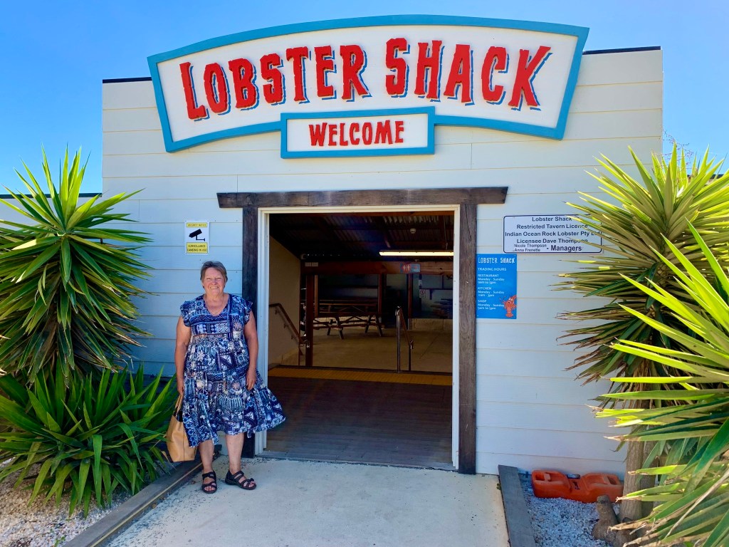
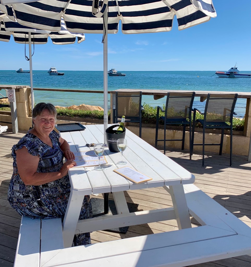
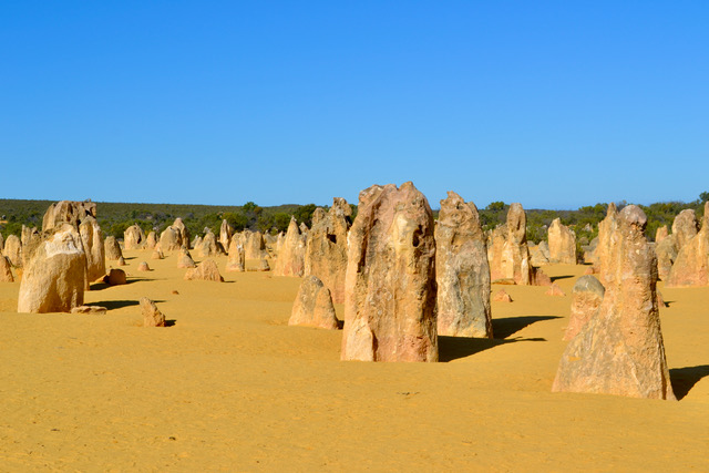
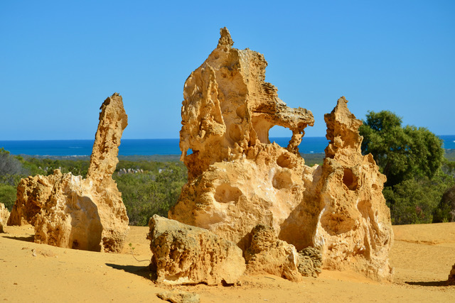
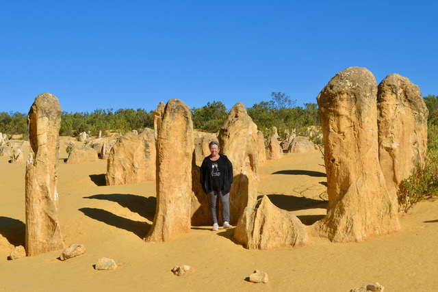
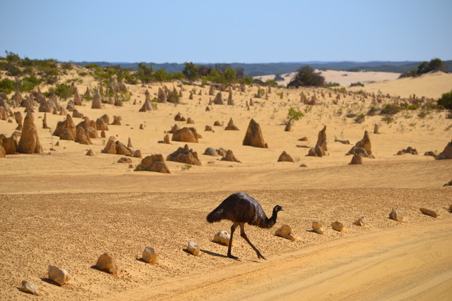
Pulling into Cervantes expecting quite a large town we were surprised to see the opposite. We were going to a donation camp at the showground but alas it was not operating. There was only one caravan park in the town which I felt was overpriced. I had found out the day before that our daughter Jess had secretly been making plans with Ken to organise a dinner voucher at The Lobster Shack ( a seafood restaurant in Cervantes) as a birthday gift for me. They know I love seafood and this place had been recommended to us. Given that situation, Ken insisted on us staying two nights in the overpriced caravan park so we could enjoy a relaxing afternoon and the next day a celebratory lunch. It was hard to argue with that. A leisurely afternoon and another nice sunset at the beach. We woke to get an early start to see The Pinnacles. I was blown away by these as I had seen photos and was expecting a small desert area with funny-shaped rocks. It is much more than this. We arrived as the park opened. As pensioners, it was only $8.00 to enter. There is a drive through the park which is part of the Nambung nature reserve. As we arrived early there was a quiet peaceful feeling as we started the slow drive. To me, it seemed like we were invading a series of secret cities silently going about the process of change. There are hundreds or maybe thousands of these “rocks” Formed approximately 25,000 to 30,000 years ago. Once the sea receded and left behind the seashells a new world emerged. Winds blew away the sand and left the pillars to stand alone and face the elements. They are all different shapes but often similarities can be seen within certain groups. You are allowed to drive and walk among the rocks but asked not to touch or climb on them. We drove and stopped many times wandering through the structures. Often you would round a corner and feel like you had just entered another town. Some are taller than people, some are wider, there are groups huddled together and others scattered away. They are all individual and yet they are the same. In one very sparse area with more open space, we were joined by three large emus’ wandering steadily across to a small shrubbed area. We were able to watch them slowly pass in front of us on a journey known only to them. I wondered if they were annoyed by our presence in this peaceful, serene setting.  Further along the track a large grey kangaroo foraging in the bushes on the side of the road gracefully emerged and hopped across the road right in front of us. We have all seen these animals many times, but I personally am always thrilled when I see them in natural surroundings simply going about their missions. It took a couple of hours to complete the drive and we finished at the visitor’s centre where they have a large display of information and photographs of The Pinnacles. Interestingly they have not yet discovered how they were formed. The actual gift shop was a little disappointing. I find the gifts are pretty much the same in every tourist centre you enter. I was prepared to buy something which represented the park as a memory, but nothing was special or unique. The same old products with different labels. I decided to wait until I found something I liked elsewhere. It did not spoil the visit as I am still thinking of its beauty days later as I write this blog. One of the highlights of the trip for me. Topped off by my special seafood lunch, at the famous Lobster Shack,  with wine and a gelato for dessert. Sitting on the balcony with a  fabulous ocean view made my day complete.

.

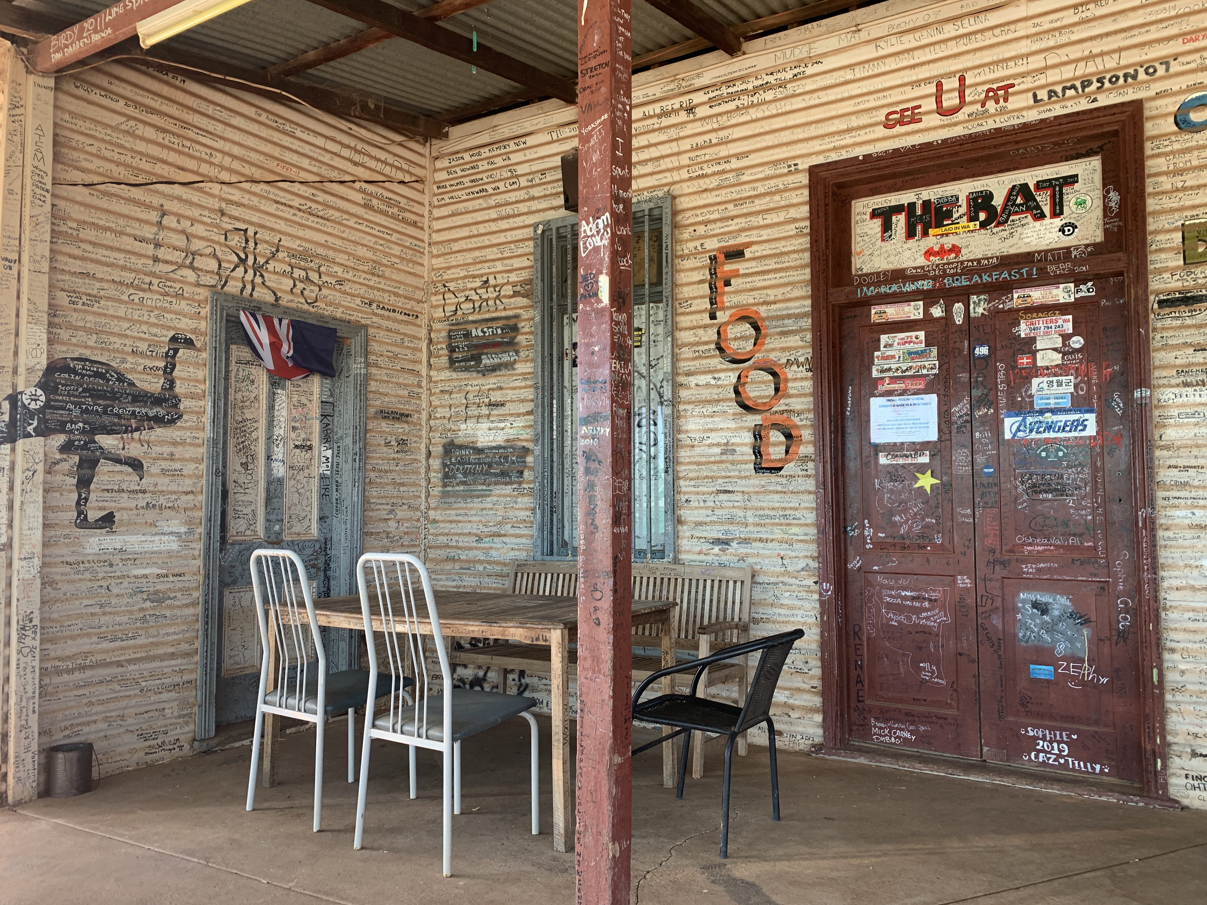
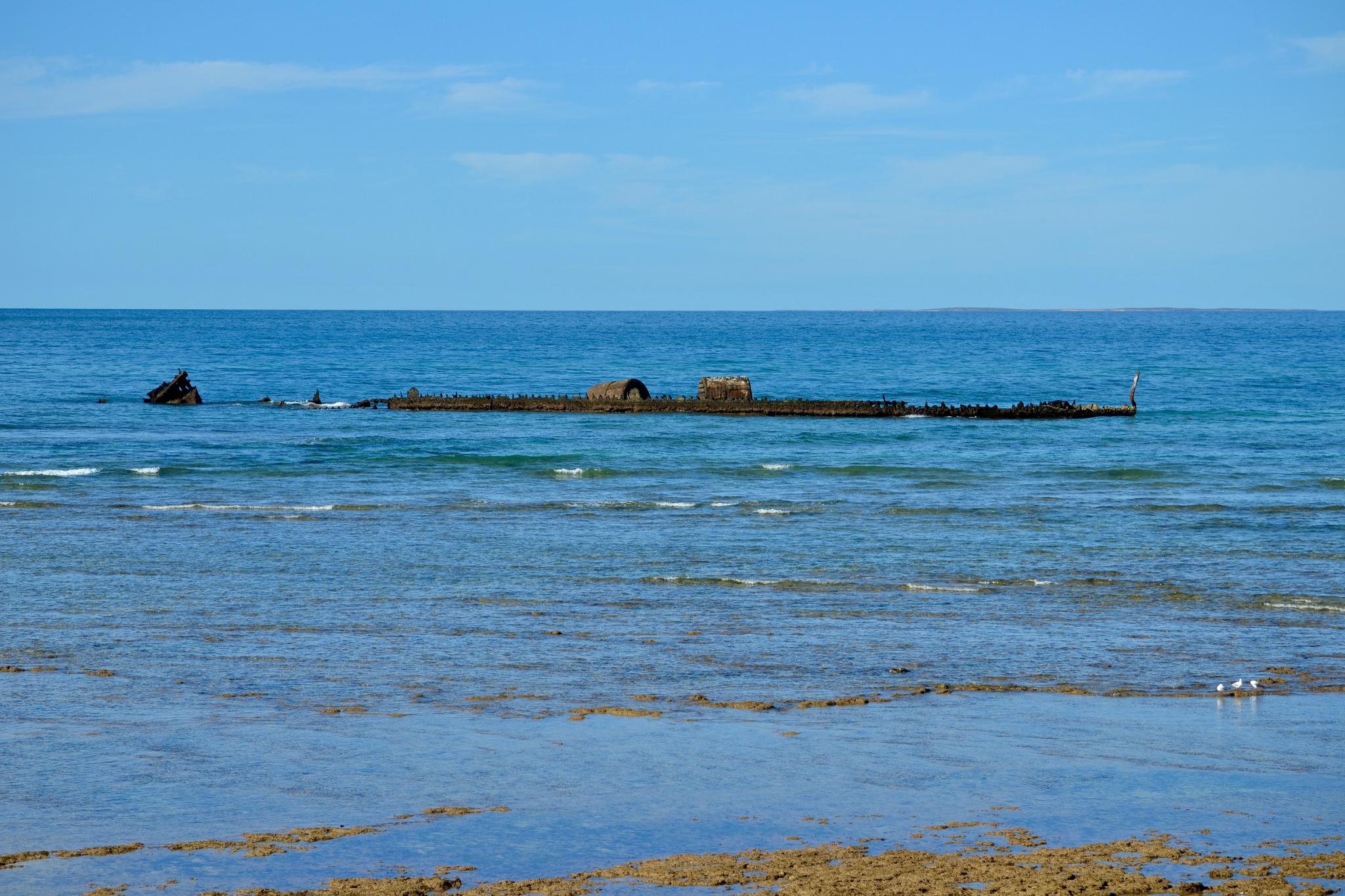
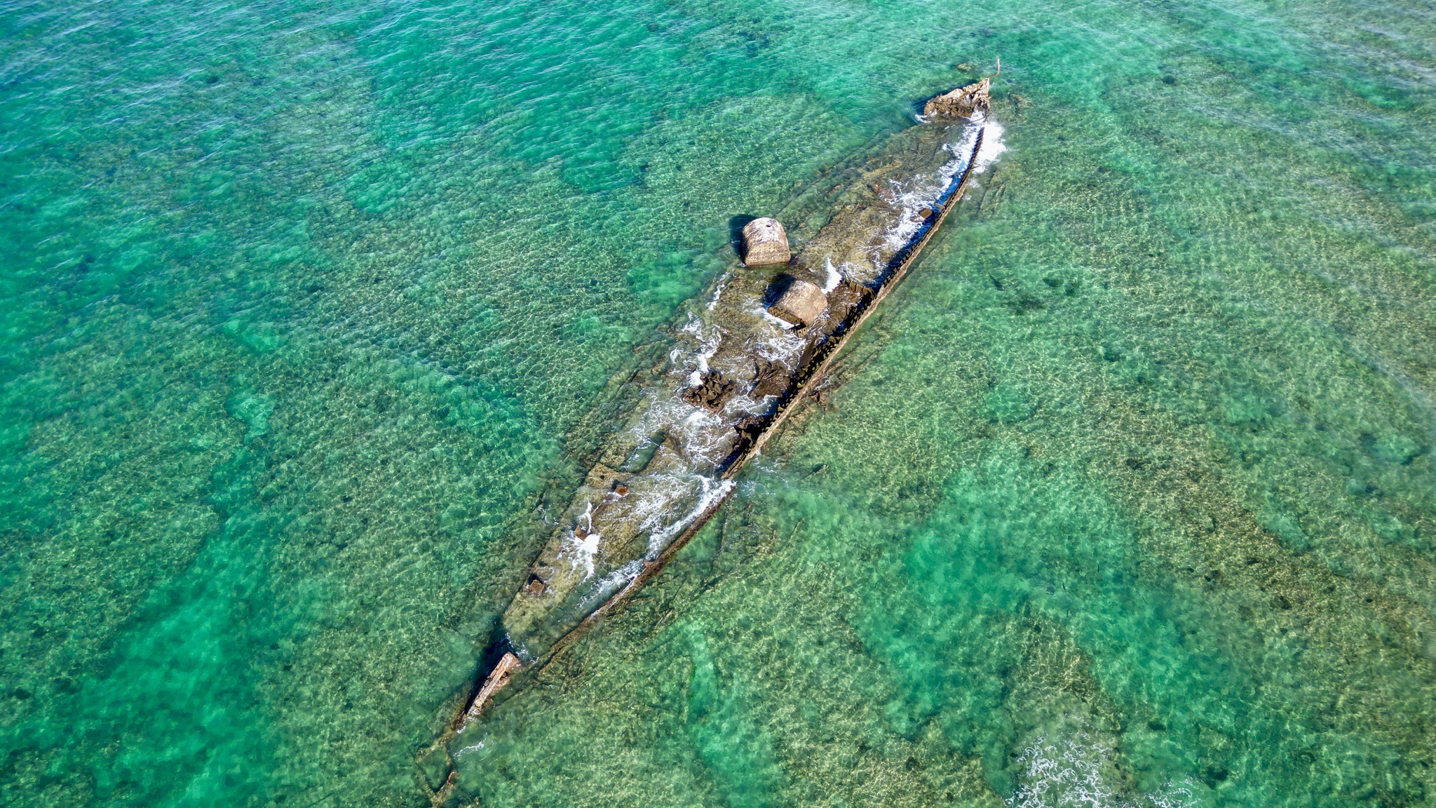
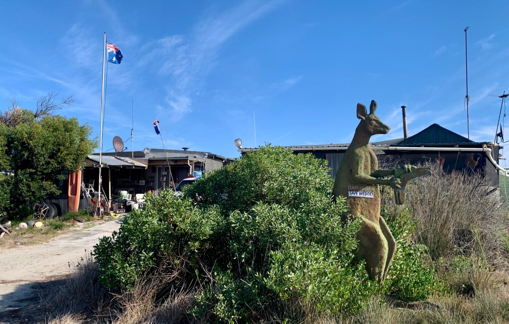
As we headed further down the highway, true to form the car was compelled to do a couple of detours on the way.  Firstly, we saw a sign for a place called Wedge Island. Asking ourselves the question, what are we going to see, wedge-tailed eagles or an interesting island in the ocean, we had no know idea at this point. A few kilometres down the road we started to see a few old shacks hidden in the bushes. As we continued there were more and more varying shapes, sizes, and conditions. There is no running water, no shops, and no electricity. There are some generators to be seen. The place looked deserted. We could see tracks to beach areas but no signs of people. It was obvious that there were residents, and a few vehicles parked among the shacks.  Reading up on this, apparently, there is up to 350 of these independent shacks or humpies scattered all through the bushy area.  It is hard to believe but during the right season up to 14,000 individuals may use these shacks for cray fishing.  Wedge is the name of the town and a small rocky island off the beach is known as Wedge Island.  You will not find one-star, let alone five-star accommodation in this town. Very interesting and intriguing place.

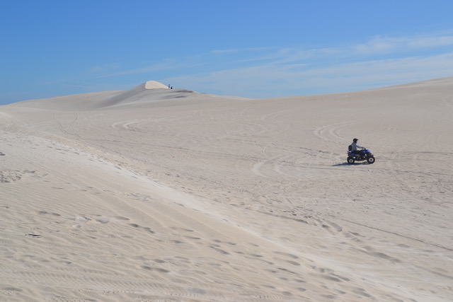
The next stop off the highway was the Lancelin sand dunes.  An absolute necessity for a 4WD is needed on these ones. You could walk all over them and had we been a bit more energetic we would have. For now, watching those on the quad bikes zoom up and down the hills and standing admiring the pristine white sand stretching for miles was enough. We used what energy we had walking up to a local lookout over the ocean. Nearby a nice little bakery satisfied us with some great pies for lunch. A note, WA make very scrumptious pies, with yummy light fluffy pastry. We endeavour to steer clear of these very frequently available bakeries.

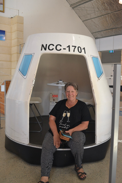
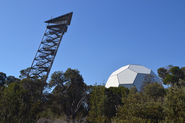
Back in the trusty Mazda once again we decided to  head inland to a small town called Hyden for a much appealing tourist attraction. First, we stopped at Gin Gin to visit the  Gravity Discovery Centre and observatory.  The advertising for this attraction is quite appealing but having now visited we would say it is better suited for educational purposes. The examples of the fundamental forces of gravity  provided, are great for hands on fun and we believe together with an overnight stay to learn about the night sky and use the observatory facilities would be worth the trip. As day tourists it is a little disappointing. Many of the displays were not functioning well and the displayed information could have been better.  We spent an hour or so there and wandered through the displays but believe there needs to be some work done to entice more people to visit. One area I think kids would love is the leaning tower, here you can recreate a 300-year-old experiment from the top of the tower. We were not enthusiastic to try it and the area surrounding it could do with some sprucing up to bring it to life. Having said that it is worth a visit.

The next leg of our drive took us through many back roads and small towns. Travelling many kilometres  via small regional towns, like Coondle and Toodyay  we found ourselves wondering where we were going. The road has little traffic, and winds endlessly through state forests, hills, and valleys with little river crossings.  It feels like you are miles from anywhere but in fact only a couple of hours  from Perth.  The countryside is pretty and reminded us of NSW. We were originally heading for Northam and then onto Hyden however after discussion we decided we would change our plans again and head back to Perth after visiting York.

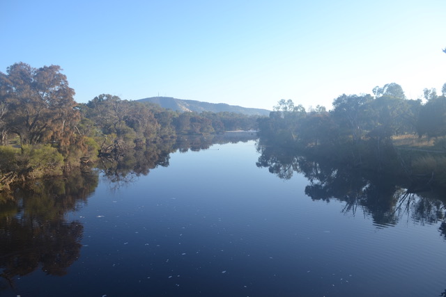
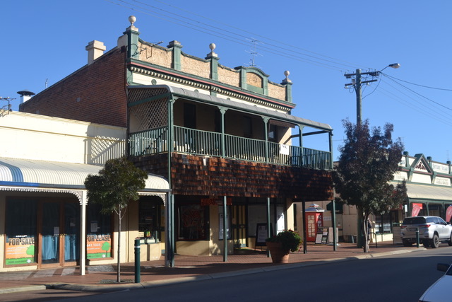
York is the oldest inland town in WA, situated on the Avon River. There were several attractions, so we started looking for a free camp to settle for the night.  It was not as easy as expected and late in the afternoon we settled on a RV site in the middle of town hoping  a quiet sleepy town would afford us a good night’s sleep. It was a pretty sight just near the Avon River. A much-needed trip to the IGA and a little drive around the quaint little town finished our day.

 Alas the sleep could have been better as we did not consider the workers leaving in the early hours of the morning crossing the local road bridge nearby.

It was the 1st of May, the actual date of my birth so a prompt decision to have a nice leisurely breakfast in town to celebrate made us scurry to pack up. My thoughts were of eggs Benedict and hot brewed coffee, I would soon be enjoying.  You must admit Weetabix and fruit can get a bit boring after a while.

We drove straight to town, had a look around the nearby  park and started a walk around some of the heritage buildings. After a leisurely stroll down the main road, I discovered my mobile phone was missing and had convinced myself I had left it in the public toilet back in the park. I was still very stuffed up with the cold and struggling with a tight chest but could not imagine surviving without my phone. We hurriedly turned back to the park to find my phone. Breathing heavily, I checked our car first and thankfully a sigh of relief as I found it sitting on the seat.  My much-needed breakfast was foremost in my thoughts, so we trotted off to find the nearest café. To our absolute dismay we were confronted with one coffee shop with preheated toasted sandwiches and no atmosphere at all. We removed ourselves quickly and wandered down the main road trying to satisfy our needs. There was nothing and so my lovely birthday breakfast was not experienced that day.  We had a takeaway coffee and decided to wait for the next town. We had a couple of small sites to see, some photographing of more heritage buildings and we were on our way again.

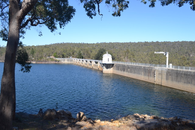
Our new destination being Perth we headed back along the Great Southern Highway where we found ourselves driving through the Mundaring State Forest. We came across the Mundaring Weir, apparently one of the world’s greatest engineering projects. It was finished in 1903 as the start of the water pipeline which pumped water 700 kilometres away to the goldfields of Kalgoorlie. The area surrounding is ideal for picnics, , canoeing, swimming  and many walks. It was midmorning on a sunny day so ideal to walk across the dam wall to look out onto the heritage museum down below and then stare out at the  bright blue water surrounded by the deep green of the bush hugging the waters edge on either side.  We spent an hour or so just enjoying the pleasant surroundings and the peacefulness of the entire area. It was a nice surprise for the day.

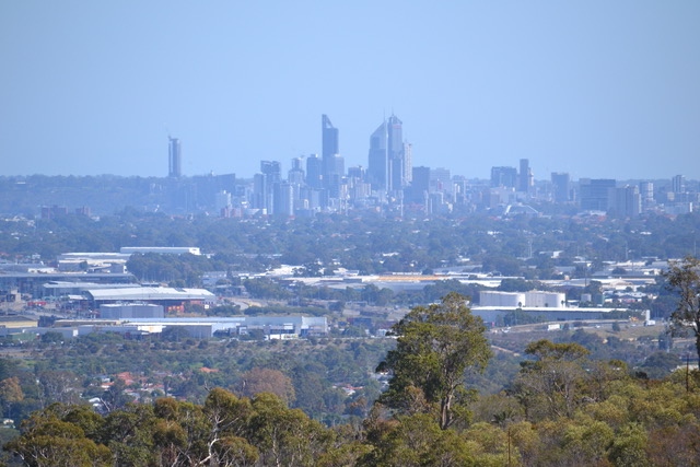
We headed down the highway for the Lesmurdie falls which I expected to be the highlight of the day. Unfortunately, the falls were not falling, and the walk was steep and hot so not exactly what we were looking forward to. The national park was however surrounded by some beautiful expensive looking homes with great views toward the city of Perth.  Accommodation was our next venture which again proved harder than expected. We were looking for a caravan park reasonably close to Perth at a acceptable price that was not booked out. Again, everything was heavily booked. Increasingly this was the case even though it was not holiday period. This caused me to ask the question why. A receptionist at one of the parks informed us that many people were living permanently in the caravan parks due to the rising expenses and lack of available properties. This made sense and made us realise we would have to be more organised over the next few weeks of travel.  Eventually we found our spot at a place called Coogee “ pronounced Coo G”  outside of Fremantle.  One advantage of the caravan parks where there is a heavy permanent residence is that they are very clean and very quiet.  We settled into this one  for a few days.  That night we went to a restaurant for a relaxing birthday dinner. After trying a couple of places which were unsatisfactory, we settled on a restaurant and enjoyed a couple of wines with our very tasty meal. 

                                    .

. We had been travelling for 4 weeks now and loving every minute of it. The majority of these photo’s have been taken by Ken with his D3100 Camera. He has a great eye and captures the essence of every place we go to. I do take photo’s with my trusty Iphone XR, but I tend to like quirky scenes which I will post in a separate blog.

The next day we were going to explore Perth CBD, Fremantle and then move along the coast to Esperance. See part 4 for our continued escapades.

Thanks for reading once again. Leave a comment and give it a thumbs up.

Western Australia Part 2

Prt 2 WA-Cocklebiddy-Exmouth Including Eclipse

In Part 1 we had called into the roadhouse at Cocklebiddy,  before leaving I felt compelled to ask the shopkeeper if the population of eight shown on the sign was genuine, she assured me it was and quickly rattled off their names one by one. She added that occasionally there was more in busy times, The 8 residents all worked and resided at the roadhouse. Lovely friendly people who said it was difficult to survive sometimes. Covid nearly killed them, but they just kept on going. True-spirited Aussies doing it tough.

We were in the last stretch of the Nullabor. With another 219 km driven, we pulled up at yet another roadhouse. Quite a lively place with a caravan park, motel, and petrol station.  Balladonia where we had been advised to check out the museum apparently centred around the Skylab crash in 1987.

The museum was neatly presented although only a tiny section of the somewhat small display was concentrated on the Skylab crash with a replica of a part of Skylab. Not exactly authentic but interesting. It’s a good rest stop and breaks the long drive, other than that we cannot be more generous about it. On the last stretch now to Norseman. This is probably the most tiring section being another 220kms and I have to say less interesting landscape than previously. So, the Nullarbor is done, and the anticipation is now gone. The sense of achievement is good and the realisation that it is not hard, not boring and in fact quite interesting. The rest of our trip will see us cover many more kilometres of long stretches which would easily challenge the degree of difficulty of the Nullarbor.

Leaving the Nullarbor, we are heading further into the outback to visit the mining areas on our way to Exmouth. The first stop is Kalgoorlie, nearly 200 km from Norseman WA. The road was good, but the landscape was very sparse all the way with very few signs of civilisation. Out of the blue, a sign for a café grabbed our attention. We turned left and drove a couple of kilometres to our amazement we came across a small town with every facility you could need,  Motels, a caravan park, Woolworths, a gym, and sports ground, etc.  I believe the town was Coolgardie, but we have no idea where the residents resided. Later in our trip, we realised there are a huge number of mines pretty much hidden all over the countryside and other than the odd fence sign you would not know they were there. Obviously, a lot of workers needed supplies, hence the town of Coolgardie.

Next, we arrive at Boulder/Kalgoorlie. My first thoughts are it is a grubby town with lots of old equipment, old buildings, and disjointed infrastructure. Pretty much what we expected. We immediately came across the road to the Super Pit. It was blowing a gale at the top of the hill but thankfully there is a large, covered area over the information boards and a fantastic viewing platform that looks over the mine. Taken from one of the boards:- “In June 1893, Paddy Hannan, Thomas Flanagan, and Dan Shea found nearly 100 ounces of gold in the dry red soil of what is now Kalgoorlie-Boulder. This sparked a gold rush and the discovery of the area known as the Golden Mile, which is one of the richest gold deposits in the world. By 1903 there were 49 operating mines, 100 headframes and more than 3,000 km of underground workings on the Golden Mile.”

Looking through the window you are faced with a  huge deep cavernous hole with walls layered in varying gold, red, grey, and brown layers of colour. Dotted with yellow trucks together with red and yellow hard hats, you could be forgiven for thinking you were in Leggoland with model trucks using makeshift roads to move the endless piles of potential gold from one layer to the next. Surreal and yet an actual working masterpiece. After checking out some of the older buildings in the town we stocked up on fuel and groceries. I have to say there was a large contingency of Aboriginals congregating around the local community centre and shopping centre who were becoming quite boisterous we did hasten our steps a little.

As we were moving into more remote places, we decided a map of WA was a good idea. The mobile had been good to date, but when there is no reception and many km of road seemingly going nowhere a printed map is vital. Popping into the Information centre, I had a chat with the local expert and found out about a couple of interesting sights to visit as we continued along this Golden Mile. Approximately 8 km out of town we pulled onto a dirt road and drove a couple of km when we came across a very large circular tin structure. Two large openings and bench seating following the curve of the shed led our imagination to a very verbal and boisterous game of two-up. I believe considerable dollars had changed hands here on many occasions. To the right was a dilapidated tin lean too with a painted sign “Mens” and further over another sort of structure which we believed to be the ladies although not marked as such.  The interesting part is knowing that this dusty piece of land was still being frequented every Sunday in the present day. I can only imagine the value of the cash passing hands today.

A little while later we turned off the highway at Broad Arrow to visit the local tavern. Nothing much there but a whole lot of evidence of who had been there. The beer was cold, and the locals came and went. Both the inside and the outside walls were totally covered in scribbled names and messages. Not a patch left bare that I could see. Such an intriguing establishment. The stories that must have been told on those bar stools would surely be worth hearing.

Menzies is another tiny town, and we were only passing through on our way to see the sculptures on Lake Ballard. It was late afternoon when we arrived but just enough time to check out a couple of the 51 iron sculptures placed all over the 7 square kilometres of this vast Salt Lake. Absolutely fascinating concept. If the rain had fallen it would have been a red muddy and unpleasant walk, but we were in luck it was dry and hard and therefore easy to navigate. Free camping is allowed, with drop toilets available. The night was pitch black with the stars shining brightly. There was absolute silence even though there were several caravans and campers scattered around. The next morning, we woke to a clear day, and an eagerness to explore. Antony Gormley was the British artist responsible for the stark black steel family of sculptures. Apparently, each one represents previous residents of the town of Menzies. They are all a little different, men, women, and children each now connected by the millions of footprints in the red salty ground.  What also makes It interesting is the out-of-place conical-shaped hill that seems to rise out of the dry Salt Lake. Covered in scrub and rocks it was quite a scramble to the top which I did attempt but gave up very quickly. Ken managed to climb up about ¾ of the way but the continuance of little avalanches of rocks deterred him from reaching the summit.

Another pleasant sight was a young boy on a bicycle having a lot of fun riding on the Salt Lake and a large brown dog expelling a lot of energy running endlessly over the dry lake.

After returning to Menzies our next stop was Kookynie town. It has been labelled a ghost town but the fact that 20 people still lived there refutes that fact.  It was quite a way off the highway and a little disappointing once we arrived. History depicts a flourishing and vibrant working town and certainly, you can see the remnants of that, but many of the buildings have fallen apart and replaced with information boards. There are some brilliant rusted-out vehicles together with plant and machinery. The brochures indicate the town is growing and I hope for their sake this is correct however I do doubt its prospects. A drive out to the Niagara Dam surprised us by actually having water in it, to date we had seen a lot of dry water holes. It was quite hot and dry but an easy walk across the dam wall.  Apparently, as soon as work started on building the dam, the town discovered an underwater bore and therefore the dam was not actually needed. Such a waste but hopefully as Wikicamps has it listed it will be enjoyed by more travellers as a free camp down near the water’s edge under the shade of the trees.

Gwallia is a mere 152 km north and it is an actual Ghost Town. Right on its edge is another very large mining exploration happening today. Luckily, they have seen fit to preserve the buildings of Gwallia as they were. There is a grand hotel, some old shops, houses, and other establishments.  We visited the reasonably thorough Museum of the Times, with a café in the old heritage home visited by Edgar Hoover before his USA presidency. It was beautifully preserved, and the tea and scones would have been thoroughly enjoyed had we not been sitting on the wide-open veranda which had a pleasant breeze to cool us down but unfortunately, the flies had the same idea. an Australian staple we were quickly tired of. Time for working and washing again so we booked a caravan park at Leonora,10 minutes from there.

The advertising for Leonora was such that I was expecting a well-looked-after town with some interesting things to see. I can honestly say this was not our experience. The people we encountered were lovely but there was little to see and the caravan park we were booked into had razor wire topping the entire perimeter. This is a little unnerving. The party started late afternoon/ early evening as some of the locals become extremely verbal. A lot of screaming, aggressive music and abusive language continued through the night.  We were going to stop for 2 nights but chose to limit it to one and hopefully find a free camp further along. I did manage to get some work done, the washing finished, and we had showers so no complaints but obviously did not sleep well that night.

Our plan at this stage was to continue our way to Karijini national park despite the current cyclone off the coast of WA above the national park. We were following it closely but at this stage, the forecasters were indicating a move to the Northern Territory, so we stayed on our planned itinerary.

Our next main stop was Mount Magnet some 432 km to the west. About 280 km along we pulled off just before the town of Sandstone following an advertised tourist trail. Sandstone was formerly a gold rush town and later nearly a ghost town, however in 2021 its population was 109 people who apparently are very proud of their town as the homes are neatly kept and overall, the town is nicely laid out and well looked after. Its claim to fame today is the greatsights you see on The Heritage Trail. Just two of the things we liked were The London Bridge and the Cave Brewery. London Bridge is aptly named and worth the drive. The scenery is wonderful and needless to say a frequently photographed tourist attraction. The Brewery is intriguing. Developed by an Irishman who built the pub at the top of the mound of limestone rock and then ran the pipes down to the cave below to keep the barrels cool.  This place is very remote and hard to imagine people going that far for a cold beer. Ken pointed out there would have been many gold seekers in need of a thirst-quenching beer after the tiresome effort of searching for their fortune all day in the summer heat.  It was getting to mid-afternoon, and we hurried on to our free camp which was not far out of Mount Magnet. Once we arrived it was a little rockier than the reviews on Wikicamps and of course, while trying to decide on the spot we gashed a rather large hole in the front tyre. We were just over half an hour from town, but it was late in the afternoon. A quick call to the local mechanic led us to believe he may be able to get us a replacement tyre. Hurriedly changing the tyre to our space-saver spare tyre, we drove the distance to the town. Alas when we got to town, he had closed along with the rest of the town, so we had to stay at a caravan park. Luckily, we were able to find a spot. Again, another caravan park that was monitored by police. A couple of phone calls the next morning convinced us we needed to drive the 350k to Geraldton as nothing was available anywhere else.  As it turns out our plan was to head for Karijini national park, but we were concerned as a cyclone had crossed into an area a couple of hundred k’s short of where we were headed. At least going to Geraldton, we would miss the bad weather from the cyclone but sadly we would miss the opportunity to see Karijini National Park. This was bitterly disappointing but unfortunately, we had no choice.

So off we went, bright and early and made it to Geraldton in time to get the new tyre. Thank you to Tyrepower who fit us in, changed our tyres around so they were evenly matched and did not overcharge us. A consolation was that the cyclone did in fact hit land nearer to our original destination than we would have liked so we were saved from some very treacherous weather by heading to the coast.

While in Geraldton we checked out the memorial for HMAS Sydney. This is quite large and beautifully designed.  The gardens surrounding it are nice and the lookout is quite appealing. Leaving here we drove down to the Esplanade. The sun was hot, and we stretched our legs with a walk to the end. Here we found a huge Crystal ball on display. Depending on the angle you can see your reflection and the ocean through the glass. Really neat and different.

Now where to stay, it was getting late, so we headed just out of town to a camp referred to as an Eco camp. We drove in and there was a house unattended and a sign to say park and leave your donation. Showers, toilets, and a camp kitchen. We drove around an oval and found some old numbers on trees which we determined were campsites. Picked one which was near the camp kitchen and set up. There was quite a large group just near us who were using the facilities and turned out to be a rowdy bunch. As the facilities looked old and unkept we decided to just use the toilet. I am not sure of the meaning of Eco camp but looked more like ‘Look after yourself Camp’.  We were up and out of there early the next morning.

Another long 480km north and we arrived at our destination, Carnarvon, we found an inexpensive caravan park that was run by a young woman who was super happy and a very hard-working lady. We stayed here 3 nights as I had work to do and we needed time to just catch up with washing, shopping and to relax a little. Once again, we expected a larger more commercial town. There was a nice esplanade, some small gift shops and coffee places and more industrial-style businesses but otherwise, an ordinary town.  We must mention though that we did visit the Space and Technology Museum which proved very entertaining with hands-on activities and a wealth of information. This was a tracking station for early space missions such as Gemini, Skylab and Apollo. It was easy to spend a couple of hours going through all the exhibitions. A very worthwhile visit. It appears small but is jammed pack with interesting and interactive highlights.

Having sorted ourselves out and prepared supplies for our 5 days at Exmouth we left on the 18th to head for our eclipse headquarters. It is 364 km to Exmouth and other than a coffee break we drove straight through. Getting close to the Exmouth turnoff Ken saw a hawk in the sky and just happened to comment that he had not seen an eagle for some time. As if by magic we passed 5 eagles hovering over roadkill on our right. As it happened Ken checked the km at that point and realised it had changed dramatically as we were going the wrong way. We had to turn back and as we drove toward the point where the eagles were feeding, we stopped and Ken walked quietly down to try for a photo. He was rewarded generously as one very large eagle held back until the last minute and he was able to photograph the eagle in flight. It was a brilliant photo and very unexpected. We of course were quite happy that we had missed that turn-off.

 It was amusing to see the many traffic warnings along the way. There were many warnings of traffic delays due to upcoming events, and frequent roads blocked off.   We personally experienced no delays of any kind and drove easily to the entrance of the overflow camp where we had booked along with hundreds or possibly thousands of others. We were cordially welcomed and were instructed to follow the man in the high-vis yellow jacket madly peddling his bicycle to our allocated spot. They were very organised, with many helpers and all just as excited as we were. We had a great spot with few vans around us. We did have to be self-sufficient so up went the annex for the first time along with the Joolca shower and toilet tent. The weather was brilliant. Hot but with a nice breeze. It was afternoon so after unpacking we went for a drive to the centre of town to find a pub and a cold beer. We had no trouble and arrived at the Froth Hotel which quite a few others tried out as well. A short drive around town we were able to get our bearings as to where the beach was, our expected viewing site for the Eclipse. It was conveniently within walking distance from our camp.  We settled down for the night in anticipation of a mass arrival of campers the next day. As it turned out there was a steady stream, but the area was huge and accommodated everyone very well. We did notice that our little corner was still not crowded out.  We were close to an exit which made it very easy to come and go. That morning we had a visit from an acquaintance, Mandy, and her husband Brian. Ken had spoken to Mandy before in relation to a visit we made to Lightening Ridge.

Mandy writes for The Outback magazine for RM Williams. She wanted to ask us about what to expect regarding the eclipse as it was her first experience. They are a happy friendly couple whose company we enjoyed. She will be doing an article, whether we are in it we will have to wait to find out. We hope she enjoyed her first eclipse as we were unable to meet up with her after the event. I am sure she would have been very busy interviewing many people about their experiences.

The morning passed quickly, and we met up with some other friends that evening for a meagre feed of sausage sandwiches accompanied by beer and wine. Earlier in the day we took a drive up to the Vlamingh Head Lighthouse, one of the few places where both sunset and sunrise can be observed over the ocean. We also visited a local beach and went for a brief dip at Town Beach. The water is warm and shallow, and you can walk knee-deep for quite a way out.  The next morning was eclipse morning, and it was decided we only needed to move a few metres from our camp. Ken had decided he would not bother trying to photograph as he wanted to be able to watch the eclipse without interference and in the end was very happy with his decision. It is a spectacular experience that everyone should endeavour to see at least once in their lifetime. It is also one of the hardest things to describe and one of the most difficult to put into words. This was my 4th eclipse and Ken’s 6th, of course not all are successful, but all are meaningful. All I can tell you is that if the sky is clear, it is an exceptional occurrence. The sky changes, the moon covers the sun and at the final moment when the sun is nearly completely covered, the image of a diamond ring appears as the last rays push through peaks and valleys  Once the sun is completely covered you will see eruptions or prominences sprout out from behind the shadow. As the sun was quite active at the time, we were lucky enough to see white baileys beads and red prominences which were a bonus. This eclipse was very short, only 57 seconds in our position. Within moments there were cheers from the field. The number of cameras clicking at the time would have been phenomenal and the number of photos showing up on Facebook pages later in the day proved the absolute joy of those who were privileged to view it. Certainly, an experience that is hard to forget. Absolutely worth the 5,500 km we had travelled so far. I look forward to 2028 when hopefully we can be a lot closer to home in the Blue Mountains of NSW when this event will occur once again with a 5-minute duration.

It was all over as quick as a wink and there was more to do and to see. We decided to try for a drive to the local national park. Some of the park had been closed off to travellers and much of the park is 4wd only. We drove out not sure of what we were going to be able to see. We passed the lighthouse from the previous day and drove on for many kilometres. Passing several side roads leading to beaches eventually, we pulled over to the Yardie Creek Gorge car park. The walk along the top of the gorge did not look too difficult and was about 3-4 km return. At the opening of the gorge and still, on a flat walking trail, there was a river barge taking people for a leisurely trip up to the centre and back. Together with some kayakers slowly meandering up the gorge, it was quite a serene picture. It was not too far up the track, and you could appreciate the beauty of the area. The high cliffs of red rock meeting the deep blue of the ocean water were worth the effort. The gorge turned around to the left and the track headed up to higher ground which looked quite manageable, until of course it wasn’t. We came across a deep ravine that would have to be navigated if one wanted to get to the top.  A little boulder hopping and then a whole lot of rock scrambling got us down and up the other side. I must admit it took a massive amount of self-talk and some encouragement from other walkers to keep me going. I am used to coming up against obstacles in our walks and usually, the challenge means there will be a reward at the end. Part of the problem with this walk was that it was hot, and I had worn a light dress with bike shorts underneath, not the best outfit for climbing. Regardless I soldiered on thinking it would flatten, not long after we came across another canyon to master! Ken turns to me and says just watch where I put my feet and follow on. Well, if my legs were as long as his and I was 20 kilos lighter I would have so much less of a problem. The challenge was met and beaten not without several cries of “I can’t do this“ once again. The sense of satisfaction is tremendous. We find ourselves above the gorge looking down onto the cliffs once again. The wind is blowing, and the sun is beating down as we stand alone looking far and wide across the many ridges. It gives one a feeling of beauty and solitude. It makes you realise just how much of Australia is untouched by humanity. Unfortunately, we had to traverse the same route on the return trip. Of course, we made it back in one piece tired and hungry. A very tasty late lunch at a waterside café and an evening of wine and cheese with our friends saw the day come to an end. Another day exploring the town and our time at Exmouth and this leg of our trip had ended. An early night and early start the next day where we headed back.

Western Australia Part 1 WA Trip 2023

Trip to Western Australia – Main purpose is to witness a total solar eclipse in Exmouth WA on 20th April 2023

We are travelling in a Mazda CX5 AWD and towing our new cub explorer, camper trailer.  We are travelling for around 7 weeks from Blue Mountains NSW Australia, through South Australia and onto Western Australia. There is a lot to see so I will be writing this as I go in sections.

Hazelbrook, Blue Mountains to  Broken Hill.

Currently writing this blog while crossing the Nullarbor Plains. An experience I would never have contemplated over the last 70 years.

It is interesting that the feeling we have when leaving Ceduna, the start of the Nullarbor, is one of excitement, given that we have just travelled over 2000km from Sydney via Broken Hill, Port Augusta, Gawler Ranges, along many long roads with very little  distraction to break the endless plains. Stretching for hundreds of kilometres either side of the road . The prospect of continuing that pattern with even less obstacles to take the eye away from the endless broken white line should seem daunting, rather than exciting.

Of course, so far along the way there has in fact been points of interest which could easily be dismissed if your mindset does not appreciate the history or the beauty of the Australian landscape.Starting off from home the rain was gently falling, leaving us with  a feeling of trepidation.  We left at 7.30am with a 7 to 8 hr drive ahead of us.The prospect of our first night being one in the rain was not exciting. Never fear as we left Sydney we left the rain behind us. Cobar NSW approximately 600 kms being our first stop.The first day of driving was passing through towns familiar to us so little to report. What we did experience later in the day was the massive wide load trucks transporting machinery across the countryside. These require  lead warning vehicles to clear the road. We came across several, some with 2 or 3 lead cars. Each time there is a need to slow down, pull to the side of the road or even stop. Add to this the very lengthy road trains which are frequent and constant, it makes a long drive interesting.

Entering  Cobar, you are confronted with a huge rusty iron, town sign representing  the  look of  the mining industry in all its glory.

Our main purpose here was to find a free camp for the night. We relied on the wiki camps  app and headed to Cobar Reservoir, where we were pleasantly surprised to find a beautiful spacious  campground surrounding a reservoir of water in the centre.  Once setup we took a walk around the water to stretch our legs before settling down with a cool glass of wine  and a relaxing evening. It was a quiet, free, and safe spot.

The next morning, we planned an early getaway, anticipating another long drive to Broken Hill. Along the way we visited Mt Grenfell historical site. Passing, many goats, kangaroos, and emu’s the drive was pleasant and a short walk from the car park we were able to site  a significant show of aboriginal art under a few overhanging rock formations. Pushing on we stopped for petrol at Wilcannia. Such a surprising place, the contrast of preserved  historical  sandstone buildings  next door to  abandoned  residence’s and  dilapidated, bordered up shops. It created a vision of beauty and a yet a feeling of sadness. Even though the town itself sits along a running river, appears to have some pretty parks the distances to travel for work would surely pose a problem for the towns people to thrive.

With 200 km to Broken Hill we had a quick lunch and hit the road  with the hope of getting into another free camp for the night. We were not so lucky This time. It was our intention to stay at a caravan park within the “Living Desert Sculptures”  We had a quick stop for some supplies, then headed out to our destination. As we arrived at the gate, we were told we needed to book online. The ranger pointed us in the direction of the sculptures at theTop of the hill as the reception was better. Alas once there we discovered nothing available for that night. As it was late in the afternoon Ken quickly took some photos of the sculptures and we headed back down to town to secure a spot to sleep. As it turned out the free camps were a distance from the town. We settled on Broken Hill Caravan Park at the end of town.  The cost was $35 but we had the luxury of very spacious and clean showers and toilets. Not surprising at all was how warm flowing water over the body is very soothing at the end of a long dusty drive.

Broken Hill has a few good attractions, one being, The Living Desert Sculptures as mentioned. Worth the trip to photograph the unique sculptures.The second recommended site would be Pro Hart Gallery. We did not visit as we were short on time, however we have been before, and it is an interesting experience whether you like his art or not. The third thing worth mentioning is the recent addition of a memorial to the miners in the area. Placed high on the mounds of iron ore rising above the town there sits a sombre dark brown iron like structure surrounded by memorabilia of old disused mining equipment. There are information boards along the walkway. A viewing platform gives a magnificent view of the entire city and a very expansive view of the mine areas. The names of all the miners are listed. Those who having given their lives in various ways to the harshness of the  surrounding land which provides many of us with the standard of living we possess today. A memorable display with a red roses lining the columns of many names of miners from near and far. Noted were the different reasons for dying and how that changed over the years.

Broken Hill to The Nullarbor.

Our first stop is a town called Peterborough (originally known as Petersburg ) a small but pretty town focused on their train heritage. The houses are small, brick and reasonably well kept. A few plagues around the centre of the town were nicely displayed  and gave a brief story of the history . We did not take the time to go through the museum but I am guessing a train enthusiast would be happy to browse it.  Another fleeting stop to take a photo of the Manna Hill station Hotel. A town of no population so not sure why such a gorgeous building exists. I have been unable to find anything much about it.   We were in fact trying to make it to Port Augusta so we hurried on.  Closing in on our destination the skyline was dotted with hundreds of wind turbines. Huge structures which in the right place, can look quite aesthetic. Another thing noticed on the road in and out of Port Augusta was quite a few trucks towing bulk kayaks or canoes.  We are assuming there is a boat building factory there., as yet we are still debating that question. Lots of hours on the road together creates lots of interesting conversations.

Port Augusta is a busy commercial working town with a military base and airport. I did expect it to be a bit more picturesque than it was. There was major work happening on the main bridge crossing the river which disrupted the traffic flow a little.  A quick stop for supplies and we headed to our next free camp. This proved a small challenge. Instruction was to go passed the military base and we would see the turn off to Question Mark Hill. The clue was in the name. The Hill in question was not huge so we missed the tiny blue caravan sign. After a second attempt we found our spot. Very isolated but looked quite safe. There was a sign on the fence running along the open area, warning us about the unexploded bombs in the area and therefore no access. We just hoped they got the fence in the right place.  We settled down to be presented with a beautiful sunset, a powerful storm in the distance and a rainbow against the brightened sky. Quite spectacular half hour.  We spent the evening watching the huge road train lights glide along the very distant highway.  The area was dark and  other than the  glowing lights of human existence on those trucks , the stars were our only neighbours. The night was silent, but the morning bought unexpected rain. Up until now we had been able to neatly pack up our gear each day  which  was not the case today. We shoved everything in wherever we could, quickly folded down the camper and headed off to find some breakfast and much needed coffee.  No problem as we pulled up to get petrol a restaurant beckoned us. After a Big breakfast which would see us through to dinner, we were off to see the sites. The Flinders Ranges Red Cliffs lookout which is among the Desert National Park. in Port Augusta. On the drive into the car park we had to wait on the way for the little family of kangaroos having a meeting in the middle of the road. Not the first time we had encountered this common occurrence.  The area beckoned us to walk along the cliff edge to view the cliffs and the bridge over the river. The deep red of the cliffs are a contrast to the grey mangroves which lap at their feet, add to that the blue of the water and you are faced with  a picturesque scene. The desert gardens surrounding us  display many of the species the naturalist Robert Brown examined and collected from the area in 1802. These species were completely new to science at that  time.

On the road again and 150kms west brings us to Kimba. Driving into the town there are signs for the Silo Art , the Big Galah, and the sculptures. Petrol is needed so we headed to the Big Galah. Quickly noticing the silo, we stopped to photograph yet another typical country scene appropriate to the area. The silos are huge, and the information plaque informs us how much paint, how long it took and the name of the artist. They are always fascinating, and we, personally think they are a piece of beauty  decorating the harsh reality of the imposing cement of the silos. I must mention the dreaded march flies at this point. We have encountered them before and found they love our blood way too much. In our opinion they are a large silent destructive annoyance of the Australian outback. They land, bite and are gone and one is left with  swelling itchy painful lumps. We kept the bushman’s aerosol  handy after that. Next, we introduced ourselves to the very large Pink Galah  sitting  perched  in front of a roadhouse. After taking one of those photo’s  you just must take even though you know everyone has one the same.  Petrol problem solved we went in search of the advertised sculptures. Stretching  our legs, we walked  up to the lookout to find a life size  iron statue of John Eyre and an aboriginal  man by his side. Continuing this road, we headed to the Gawler Ranges national park.

We were aware this area was best travelled in a 4WD however information gained told us it was suitable in places for  less than that.  It was not too long before we hit the orange dirt of an unsealed road. Even though the camper and the car handled the corrugated rough road, it was a slow and careful drive.  100 km’s later we pulled into a our pre-booked camping spot. No person or vehicle in site, we were happy to see the place completely deserted. No Internet, no people, no traffic. The quietness experienced in these areas is quite addictive. After unpacking we took off on a 4 km round trip walk to a rocky granite  outcrop. Some interesting boulders at the end made it worth the effort. The following day we had a long drive around the Park to see what is known as the pipe organ. . On the drive we stopped at a homestead, built, and occupied in the 1800’s. Surprisingly we were able to enter inside. Photos and information posters were displayed giving us a history of the past families and a small window into the way they lived. The surrounding area was interesting and well preserved. The wind was blowing, and the rain was starting to dampen the red earth. The conditions that people lived in were rough enough but the harsh weather in these places would have been unforgiving. Moving on toward the main attraction, the pipe organ rock formation we were disappointed to discover we needed a 4WD to see them. The road was very uncertain. We had the choice of camping another night and trying the next day or moving on. The weather was a deterrent, so we decided to keep going to our next destination. The road out of the park was a lot rougher so we lowered the tyre pressure  which made it a lot easier. Luckily the rain diminished and  fortunately we spotted  a sign to the Pildappa rocks. This was something on our list to see but thought it was further afar. Quickly turning back, we followed the sign and were met with the massive  granite rock formations.

The rocks are an impressive sight being the highest and longest wave formation on the Eyre Peninsular. It is pink granite and dates 1500million years. There is some free camping around the area so rush to investigate the entire site. If visiting for the day you are able to  drive or walk the perimeter of the rock and in fact can climb to the top. When at the top you can see the countryside for many kilometres. Quite an amazing feeling and certainly not a difficult task. It was a little too windy for us to camp, so we headed back to the main highway very satisfied that we had not missed this natural phenomenon. Further down the road we came across another tourist sign to Tcharkuldu Rock. or boulders.  Not expecting to see much we were pleasantly surprised at this large array of boulders. Some sitting precariously looking ready to topple any moment. Another photographers  delight and something we had not expected to see. Now to find our next campsite.  Once again thanks to Wiki camps we secured a great spot in a town called Wirulla. It was Good Friday so the one shop and one hotel in the town. were closed. We had been looking forward to showers and getting some washing done but at first sign that was not going to be possible, as the shop was the place to pay and secure access to the facilities. We decided we would stay anyway and were lucky enough to be offered an access key by another camper who had arrived the day before. Washing was not possible as no coins available. but the much-craved shower was enjoyed immensely. The red earth which is a major part of this trip so far had started to grind its way into our skin and into everything else.The hot shower made up for the fact that our secret little camp was in fact quite quite noisy for sleeping as the highway trucks were persistant and closer than we thought.

Ceduna, the town at the beginning of the Nullarbor plains were around 140 kms where we stocked up, filled up with petrol and started on the unknown challenge of crossing the Nullarbor.  Surprisingly we stopped for petrol and ran into some friends heading the same way. Quite remarkable to actually be in the same petrol station after travelling so far.

As previously started this particular blog was started as we started our journey along this most anticipated road. The Nullarbor plains stretches in full approx. 1100kms. Many years ago, I think to drive it would have been quite dangerous and harrowing. People were afraid for us even today because of the difficulties of others in previous years. We had done quite a bit of research and believed it would not be as difficult as some thought. However the unknown is always a little fearful. . The land is desolate but the number of travellers are prolific.   Our first stop was Penong, home of the windmill museum.  An arrangement of windmills of all designs and sizes is such a quirky start to this leg of the journey.  Moving on the next time to stop is at The Head of the Bite” an obvious description of this lookout. There is a whaling station, visitor centre and a lookout, where in the right season, whales and dolphins can be seen. There is a fee of $8 pp. It is the first glimpse of the ocean and the fascination of seeing what is known as The Great Australian Bite. It would certainly have been worth the money had we seen whales, but it was.the wrong time of the year for us. The view is very nice though. Stopping for petrol at the Nullarbor roadhouse we hurriedly moved onto to what our  next free camp would be, on the edge of The Bunda Cliffs, a place  we had been. eagerly waiting to see. The view along the cliffs, the contrast of  the  blue ocean and the  wild white waves  striking  hard against the red, white, and grey cliffs leaves you with the  feeling of beauty. and danger simultaneously.  No safety fences, no structures inhibiting the view, just the jagged edge of the cliff face meeting the harsh plains of the Nullarbor. There were a few caravans already there. so, we found a spot a few metres back from the edge and opened the trailer.  The cliff extends for many kilometres so before the sun set, we went for a long walk up and down the cliff edge. Beautiful experience indeed. As time passed the light wind started to intensify a little and our cub camper canvas walls billowed in and out.  It is hard to move your mind away from the thoughts of the van being.lifted and sent over the edge. You know it is not going to happen, but the underlying  thoughts remained throughout the night.  We awoke early to a beautiful sunrise and an appreciation of having this.experience and the prospect of travelling further. A couple more side roads gave  us different views of the cliffs which were all breathtaking.  We then reached The Border Village the cross over between SA and WA.

So far there had been long stretches of driving with nothing but low lying scrub for many kilometres but there are many stops. along the way  for fuel, food, and places to stay. Certainly, better suited to caravan or campers as there are not only caravan parks but numerous spots for free camping

A  very large Kangaroo greets you as you drive into town. Other than that, there is a  petrol station and quarantine station. Being stripped of the few remaining veggies we had on board we were able to move on to  Eucla  to see the

Derelict sand covered postmasters’ residence. There was enough building left to be able to determine the overall size and function but what destroyed the e view was the human element of graffiti.  It never ceases to amaze me that people can be so  thoughtless and destructive. I cannot fathom what makes scratching your name in a wall satisfying. It is just demoralising to think there are people like that in the world.  Walking to the beach behind the hills of the residence you will see a fairly substantial  disused jetty built in 1890.  A photographic gem. Carrying on we see the famous 90mile sign indicating the longest straightest  stretch of road in Australia.  There is no

Arguing with that statement. The scenery does not change much, and the road can be seen so far ahead. It is quite surreal. More petrol and coffee stop until we eventually.

Get to Cocklebiddy.  A famous sign found at the roadhouse state some interesting facts. See photo below. 

Part 2 you will follow us from Norseman at the end of the Nullarbor Plains through to Exmouth WA.

I hope you are enjoying and contemplating doing similiar yourself. So far it has been a wonderful trip and our Cub Explorer has served us well. It is easy to tow, everyday it is getting easier to setup and then the pack up. We have our jobs sorted now.